Stockton in San Joaquin County, California — The American West (Pacific Coastal)
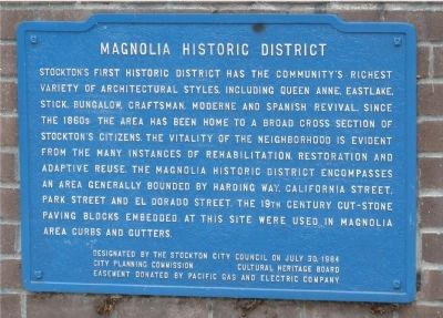
Magnolia Historic District
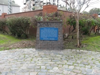
Stocktonís first historic district has the communityís richest variety of architectural styles, including Queen Anne, Eastlake, Stick, Bungalow, Craftsman, Moderne and Spanish Revival. Since the 1860ís the area has been home to a broad cross section of Stocktonís citizens. The vitality of the neighborhood is evident from the many instances of rehabilitation, restoration, and adaptive reuse. The Magnolia Historic District encompasses an area generally bounded by Harding Way, California Street, Park Street and El Dorado Street. The 19th century cut stone paving blocks embedded at this site were used in Magnolia area curbs and gutters.
Erected by : This area was designated as a historic district by the Stockton City Council on July 30, 1984, City Planning Commission & Cultural Heritage Council. Easement donated by Pacific Gas & Electric Company.
Topics. This historical marker is listed in these topic lists: Notable Buildings • Notable Places.
Location. 37° 57.834′ N, 121° 17.416′ W. Marker is in Stockton, California, in San Joaquin County. Marker is at the intersection of East Magnolia Street and North San Joaquin Street, on the right when traveling east on East Magnolia Street. Touch for map. Marker is in this post office area: Stockton CA 95202, United States of America. Touch for directions.
Other nearby markers. At least 8 other markers are within walking distance of this marker. Circle of Palms (approx. 0.2 miles away); Stockton Developmental Center (approx. 0.2 miles away); Superintendent's Residence (approx. 0.2 miles away); Doctors' Row Historic District (approx. ľ mile away); Magnolia Mansion (approx. ľ mile away); Doctor's Row (approx. ľ mile away); St. Agnes School and Convent (approx. 0.3 miles away); University Park Water Tower (approx. 0.3 miles away). Touch for a list and map of all markers in Stockton.
Also see . . . The Historic Magnolia District. City of Stcokton PDF:
Download this self-guided walking tour of the Magnolia Historic District (Submitted on October 30, 2009, by Syd Whittle of Mesa, Arizona.)
Additional keywords. architecture
Credits. This page was last revised on March 25, 2022. It was originally submitted on February 9, 2009, by Syd Whittle of Mesa, Arizona. This page has been viewed 1,971 times since then and 116 times this year. Photos: 1, 2. submitted on February 9, 2009, by Syd Whittle of Mesa, Arizona.

