Marker Logo HMdb.org THE HISTORICAL
MARKER DATABASE
“Bite-Size Bits of Local, National, and Global History”
Near Earleville in Cecil County, Maryland — The American Northeast (Mid-Atlantic)
 

Rose Hill


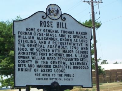
Rose Hill Marker image. Click for full size.
Photographed By Beverly Pfingsten, July 14, 2007
1. Rose Hill Marker
Inscription. Home of General Thomas Marsh Forman (1758–1845), Aide to General William Alexander, known as Lord Stirling, and a representative in the General Assembly, 1790 and 1800. He served with Major George Armistead, Fort McHenry, 1814. A later owner, William Ward, represented Cecil County in the General Assembly, 1875, and married Charlotte Ringgold Knight of Essex Lodge.

Not open to the public

 
Erected by Maryland Historical Society.
 
Topics. This historical marker is listed in these topic lists: Forts and CastlesSettlements & SettlersWar of 1812. A significant historical year for this entry is 1790.
 
Location. 39° 24.034′ N, 75° 57.434′ W. Marker is near Earleville, Maryland, in Cecil County. Marker is on Grove Neck Road, 1.3 miles west of Pond Neck Road, on the left when traveling west. Touch for map. Marker is at or near this postal address: 1100 Grove Neck Rd, Earleville MD 21919, United States of America. Touch for directions.
 
Other nearby markers. At least 8 other markers are within 2 miles of this marker, measured as the crow flies. Mount Harmon Plantation (approx. one mile away); Woodlawn (approx. 1.3 miles away); On the Wild Side (approx. 1˝ miles away); Hilltop View (approx. 1.6 miles away); History Quest (approx. 1.6 miles away); Mount Harmon Plantation at World's End
Paid Advertisement
Click on the ad for more information.
Please report objectionable advertising to the Editor.
Click or scan to see
this page online
(approx. 1.7 miles away); Plantation Life in the Colonial Era (approx. 1.7 miles away); Tobacco and Mount Harmon (approx. 1.7 miles away). Touch for a list and map of all markers in Earleville.
 
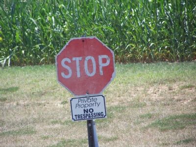
Rose Hill is 1 mile off the road and not visible from Grove Neck Road image. Click for full size.
Photographed By Beverly Pfingsten, July 14, 2007
2. Rose Hill is 1 mile off the road and not visible from Grove Neck Road
Most of the Colonial homes in Southern Cecil County are located near the rivers. Water was the main form of transportation and the estates shipped their products by boat.
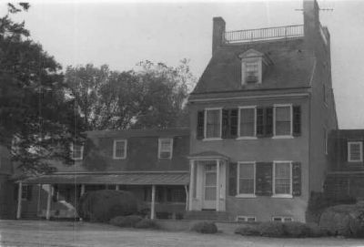
Rose Hill image. Click for full size.
Maryland Historical Trust (Historic Sites Survey), October 1978
3. Rose Hill
Many more photographs of Rose Hill, including the interior, are available from the Maryland Historical Trust (Historic Sites Survey).
 
 
Credits. This page was last revised on January 12, 2020. It was originally submitted on July 15, 2007, by Bill Pfingsten of Bel Air, Maryland. This page has been viewed 2,172 times since then and 34 times this year. Last updated on January 8, 2020, by Carl Gordon Moore Jr. of North East, Maryland. Photos:   1, 2. submitted on July 15, 2007, by Bill Pfingsten of Bel Air, Maryland.   3. submitted on March 4, 2008, by Christopher Busta-Peck of Shaker Heights, Ohio.
Share this page.  
Share on Tumblr
m=144249

CeraNet Cloud Computing sponsors the Historical Marker Database.
This website earns income from purchases you make after using our links to Amazon.com. We appreciate your support.
Paid Advertisement
May. 8, 2024