Concord in Middlesex County, Massachusetts — The American Northeast (New England)
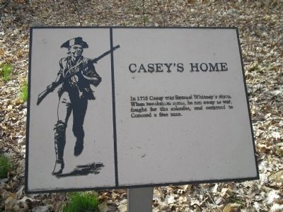
Casey’s Home
Erected by Minute Man National Historical Park.
Topics. This historical marker is listed in these topic lists: African Americans • War, US Revolutionary. A significant historical year for this entry is 1775.
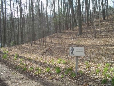
Location. 42° 27.535′ N, 71° 20.034′ W. Marker is in Concord, Massachusetts, in Middlesex County. Marker is on Lexington Road, on the right when traveling west. Marker is on a trail near the Wayside in Minute Man National Historical Park. Touch for map. Marker is in this post office area: Concord MA 01742, United States of America. Touch for directions.
Other nearby markers. At least 8 other markers are within walking distance of this marker. The First Settlement - 1635 (within shouting distance of this marker); Nathaniel Hawthorne (within shouting distance of this marker); The Larch Path (within shouting distance of this marker); Orchard House (about 300 feet away, measured in a direct line); Ephraim Wales Bull (about 700 feet away); Bedford Minutemen (approx. 0.4 miles away); Meriam’s Corner (approx. half a mile away); a different marker also named Meriam’s Corner (approx. half a mile away). Touch for a list and map of all markers in Concord.
More about this marker. The left of the marker contains a picture of Casey as a Colonial soldier.
Also see . . .
1. Minute Man National Historical Park. National Park Service website. (Submitted on May 2, 2009, by Bill Coughlin of Woodland Park, New Jersey.)
2. Battle of Concord. "Public Shelf" entry (Submitted on May 2, 2009, by Bill Coughlin of Woodland Park, New Jersey.)
3. Battles of Lexington and Concord. Wikipedia entry (Submitted on January 26, 2021, by Larry Gertner of New York, New York.)
4. Underground Railroad history at Concord’s Wayside. "New Boston Post" entry (Submitted on January 26, 2021, by Larry Gertner of New York, New York.)
Credits. This page was last revised on January 26, 2021. It was originally submitted on May 2, 2009, by Bill Coughlin of Woodland Park, New Jersey. This page has been viewed 1,412 times since then and 25 times this year. Photos: 1, 2. submitted on May 2, 2009, by Bill Coughlin of Woodland Park, New Jersey. 3. submitted on October 8, 2010, by Bill Pfingsten of Bel Air, Maryland.


