Near Wickliffe in Ballard County, Kentucky — The American South (East South Central)
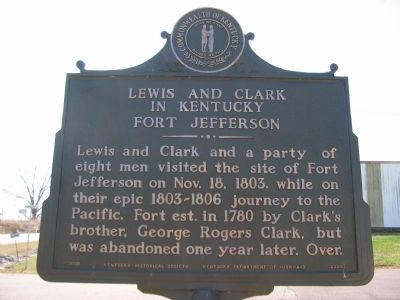
Lewis and Clark in Kentucky Fort Jefferson
Lewis and Clark and a party of eight men visited the site of Fort Jefferson on Nov. 18, 1803, while on their epic 1803-1806 journey to the Pacific. Fort est. in 1780 by Clark's brother, George Rogers Clark, but was abandoned one year later. Over.
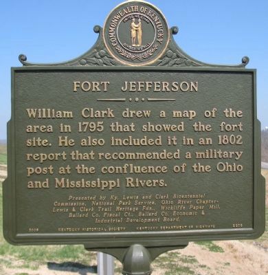
(South Side):
William Clark drew a map of the area in 1795 that showed the fort site. He also included it in an 1802 report that recommended a military post at the confluence of the Ohio and Mississippi Rivers.
Presented by Ky. Lewis and Clark Bicentennial Commission, National Park Service, Ohio River Chapter - Lewis & Clark Trail Heritage Fdn., Wickliffe Paper Mill, Ballard Co. Fiscal Ct., Ballard Co. Economic & Industrial Development Board.
Erected 2006 by Kentucky Historical Society and Kentucky Department of Highways. (Marker Number 2209.)
Topics and series. This historical marker is listed in this topic list: Exploration. In addition, it is included in the Kentucky Historical Society, and the Lewis & Clark Expedition series lists. A significant historical month for this entry is October 1935.
Location. 36° 57.334′ N, 89° 5.469′ W. Marker is near Wickliffe, Kentucky, in Ballard County. Marker is on Westvaco Road (U.S. 51/62), on the right when traveling south. Located at the entrance to Fort Jefferson Memorial Cross Park. Touch for map. Marker is in this post office area: Wickliffe KY 42087, United States of America. Touch for directions.
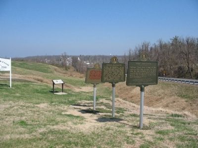
Other nearby markers. At least 8 other markers are within one mile of this marker, measured as the crow flies. Fort Jefferson Site / Indian Massacre (here, next to this marker); Union Supply Base (here, next to this marker); Fort Jefferson (a few steps from this marker); Fort Jefferson Memorial Cross at the Confluence (about 800 feet away, measured in a direct line); Lewis & Clark at Old Fort Jefferson (approx. 0.2 miles away); County Named, 1842 (approx. 0.7 miles away); Private First Class Robert Monroe Hammonds (approx. 0.7 miles away); The Prince of the French Explorers (approx. one mile away). Touch for a list and map of all markers in Wickliffe.
Credits. This page was last revised on June 3, 2021. It was originally submitted on May 2, 2009, by Craig Swain of Leesburg, Virginia. This page has been viewed 1,789 times since then and 63 times this year. Photos: 1, 2. submitted on May 2, 2009, by Craig Swain of Leesburg, Virginia. 3. submitted on May 1, 2009, by Craig Swain of Leesburg, Virginia.


