Prescott in Yavapai County, Arizona — The American Mountains (Southwest)
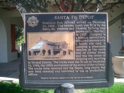
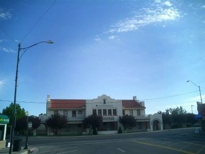
Santa Fe Depot
Erected by The Historic Preservation Fund and the City of Prescott.
Topics. This historical marker is listed in these topic lists: Landmarks • Railroads & Streetcars. A significant historical month for this entry is December 1767.
Location. 34° 32.709′ N, 112° 28.128′ W. Marker is in Prescott, Arizona, in Yavapai County. Marker is at the intersection of Sheldon Street (Arizona Route 89) and Cortez Street, on the right when traveling south on Sheldon Street. Touch for map. Marker is in this post office area: Prescott AZ 86301, United States of America. Touch for directions.
Other nearby markers. At least 8 other markers are within walking distance of this marker. J. I. Gardner Store (about 400 feet away, measured in a direct line); The Ehle Family and the Montezuma Hotel (about 600 feet away); Sacred Heart Catholic Church and Rectory (about 600 feet away); Head Hotel (approx. 0.2 miles away); Hassayampa Inn (approx. 0.2 miles away); Prescott National Bank (approx. 0.2 miles away); Bashford Block (approx. ¼ mile away); The Bank of Arizona and the Electric Buildings (approx. ¼ mile away). Touch for a list and map of all markers in Prescott.
Also see . . .
1. Sante Fe Surviving Depots – Arizona. A short article and a photo of the depot. (Submitted on May 9, 2009, by Syd Whittle of Mesa, Arizona.)
2. Prescott Past. A short history and photos of Prescott's trains. (Submitted on May 9, 2009, by Syd Whittle of Mesa, Arizona.)
Credits. This page was last revised on June 16, 2016. It was originally submitted on May 9, 2009, by Joseph Cavinato of Fountain Hills, Arizona. This page has been viewed 1,839 times since then and 119 times this year. Photos: 1. submitted on May 9, 2009, by Joseph Cavinato of Fountain Hills, Arizona. 2. submitted on June 27, 2009, by Joseph Cavinato of Fountain Hills, Arizona. • Syd Whittle was the editor who published this page.

