Harpers Ferry in Jefferson County, West Virginia — The American South (Appalachia)
House Ruins
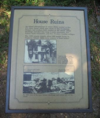
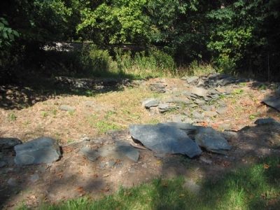
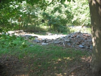
The 1850 census reveals about 200 people living on Virginius Island. Only ruins remain of their homes.
Topics. This historical marker is listed in this topic list: Industry & Commerce. A significant historical year for this entry is 1850.
Location. 39° 19.278′ N, 77° 44.26′ W. Marker is in Harpers Ferry, West Virginia, in Jefferson County. Marker can be reached from Shenandoah Street (Business U.S. 340), on the right when traveling east. Located on Virginius Island in Harpers Ferry National Historic Site. Touch for map. Marker is in this post office area: Harpers Ferry WV 25425, United States of America. Touch for directions.
Other nearby markers. At least 8 other markers are within walking distance of this marker. Head Gates and Inner Basin (a few steps from this marker); Railroads (within shouting distance of this marker); River Wall (about 400 feet away, measured in a direct line); Island Mills (about 400 feet away); Jonathan Child House (about 500 feet away); Island Access (about 500 feet away); Shenandoah Pulp Factory (about 800 feet away); Jefferson Rock (approx. 0.2 miles away). Touch for a list and map of all markers in Harpers Ferry.
More about this marker. In the center is a photo captioned Virginius Island house and residents, circa 1865. A backyard view of this house is depicted in the lower, right-hand corner of the photograph below.
The lower photo is An 1865 view of the many houses, dwellings, and cotton mill on the island.
Credits. This page was last revised on June 16, 2016. It was originally submitted on May 13, 2009, by Craig Swain of Leesburg, Virginia. This page has been viewed 834 times since then and 13 times this year. Photos: 1, 2, 3, 4. submitted on May 13, 2009, by Craig Swain of Leesburg, Virginia.


