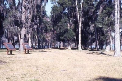
Eutawville in Orangeburg County, South Carolina — The American South (South Atlantic)
Battle of Eutaw Springs
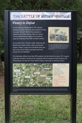
Victory in Defeat
On the morning of September 8, 1781, General Nathanael Greene's American army attacked Colonel Alexander Stewart's British Force camped at a plantation near Eutaw Springs. Here two almost evenly matched armies slugged it out in the last major Revolutionary War battle in South Carolina.
In over three hours of brutal combat, American and British forces traded musket volleys and bayonet charges. Greene's troops drove the British back into their camp, but the British regrouped and forced Greene from the battlefield.
The Americans suffered more than 500 casualties, but the British lost nearly 700. Crippled by the loss of almost a third of his command, Stewart retreated toward Charleston the following day, leaving most of the South Carolina countryside in American control.
( Reverse text)
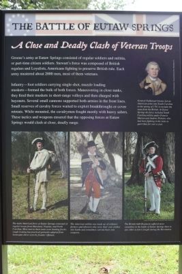
A Close and Deadly Clash of Veteran Troops
Greene's army at Eutaw Springs consisted of regular soldiers and malitia, or part-time citizen soldiers. Stewart's force was composed of British regulars and Loyalists, Americans fighting to preserve British rule. Each army mustered about 2000 men, most of them veterans.
Infantry- foot soldiers carrying single-shot, muzzle loading- muskets formed the bulk of both forces. Maneuvering in close ranks, they fired their muskets in short-ranged volleys and then charged with bayonets. Several small cannons supported both armies in the front lines. Small reserves of cavalry forces waited to exploit breakthroughs or cover retreats. While mounted, the cavalrymen fought mostly with heavy sabers. These tactics and weapons ensured that the opposing forces at Eutaw Springs would clash at close, deadly range.
Topics. This historical marker is listed in these topic lists: Patriots & Patriotism • War, US Revolutionary. A significant historical date for this entry is September 8, 1869.
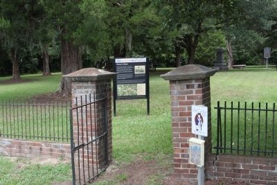
Location. 33° 24.44′ N, 80° 17.92′ W. Marker is in Eutawville, South Carolina, in Orangeburg County. Marker is on Old Number Six Highway (State Highway 6 / 45) near Fredcon Road, on the left when traveling east. Located at the Battleground Park. Touch for map. Marker is in this post office area: Eutawville SC 29048, United States of America. Touch for directions.
Other nearby markers. At least 8 other markers are within 4 miles of this marker, measured as the crow flies. Eutaw Springs Battlefield Park (a few steps from this marker); Battle of Eutaw (a few steps from this marker); a different marker also named Battle of Eutaw Springs (a few steps from this marker); a different marker also named Battle of Eutaw Springs (a few steps from this marker); Grave of Major Majoribanks / Northampton (within shouting distance of this marker); Santee Limestone / Limestone and Marl Formations (about 300 feet away, measured in a direct line); Eutawville (approx. 2˝ miles away); Berkeley County (approx. 3.8 miles away). Touch for a list and map of all markers in Eutawville.
Regarding Battle of Eutaw Springs. "Eutaw" is the Cherokee word for "pine tree".
Also see . . . The American Revolutionary War. The Battle of Eutaw Springs (Submitted on August 21, 2009, by Mike Stroud of Bluffton, South Carolina.)
Photographed By Battle of Eutaw Springs Marker
3. Front Upper picture :Courtesy of South Caroliniana Library, U.of S.C., Columbia
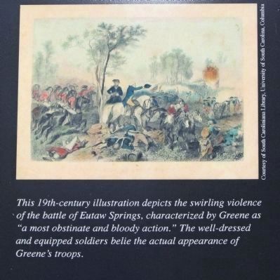
This 19th-century illustration depicts the swirling violence of the Battle of Eutaw Springs, characterized by Greene as "amost obstinate and bloody action." The well-dressed and equipped soldiers belie the actual appearance of Greene's troops.
Photographed By Battle of Eutaw Springs Marker
4. Front Lower picture: Created by Ashley Chapman
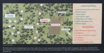
The battle started several hundred yards west of here, after Greene's troops captured a large body of British soldiers foraging for food. Greene attacked in three lines, with his artillery deployed in the road. To meet the Americans, Stewart arrayed his soldiers in a single line of battle, his artillery stationed at various points along the line.
Photographed By Battle of Eutaw Springs Marker
5. Battle of Eutaw Springs Marker, Rear Lower
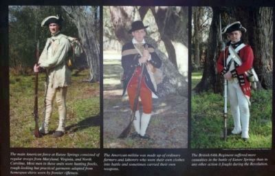
left: The main American force at Eutaw Springs consisted of regular troops from Maryland, Virginia, and North Carolina. Most men in these units wore hunting frocks, rough-looking but pratical garments adapted from homespun shirts worn by frontier riflemen.
center: The American militia was made up of ordinary farmers and laborers who wore their own clothes into battle and sometimes carried their own weapons.
right: The British 64th regiment suffered more casualties in the battle of Eutaw Springs than in any other action it fought during the Revolution
center: The American militia was made up of ordinary farmers and laborers who wore their own clothes into battle and sometimes carried their own weapons.
right: The British 64th regiment suffered more casualties in the battle of Eutaw Springs than in any other action it fought during the Revolution

Photographed By Battle of Eutaw Springs Marker
6. Rear Upper right: Courtesy of Independence National Historical Park, Phila. Pa.
General Nathanael Greene led an American army in South Carolina in the Spring of 1781 to reclaim the state from the British. At Eutaw Springs his force included South Carolina militia under Francis Marion and Andrew Pickins, who had been fighting in the state as guerrillas for over a year.
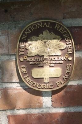
Photographed By Mike Stroud, September 8, 2011
8. Battle of Eutaw Springs Medallion added
National Register Of Historic Places:
Eutaw Springs Battleground Park *** (added 1970 - Site - #70000593) ♦ 2 mi. E of Eutawville on SC 6 and 45, Eutawville ♦ Historic Significance: Event ♦ Area of Significance: Military ♦ Period of Significance: 1750-1799 ♦ Owner: State ♦ Historic Function: Defense, Funerary ♦ Historic Sub-function: Battle Site, Graves/Burials ♦ Current Function: Landscape ♦ Current Sub-function: Park
Eutaw Springs Battleground Park *** (added 1970 - Site - #70000593) ♦ 2 mi. E of Eutawville on SC 6 and 45, Eutawville ♦ Historic Significance: Event ♦ Area of Significance: Military ♦ Period of Significance: 1750-1799 ♦ Owner: State ♦ Historic Function: Defense, Funerary ♦ Historic Sub-function: Battle Site, Graves/Burials ♦ Current Function: Landscape ♦ Current Sub-function: Park
Credits. This page was last revised on June 16, 2016. It was originally submitted on August 21, 2009, by Mike Stroud of Bluffton, South Carolina. This page has been viewed 2,493 times since then and 45 times this year. Photos: 1, 2, 3, 4, 5, 6, 7. submitted on August 21, 2009, by Mike Stroud of Bluffton, South Carolina. 8. submitted on October 1, 2011, by Mike Stroud of Bluffton, South Carolina. 9, 10. submitted on August 21, 2009, by Mike Stroud of Bluffton, South Carolina. • Craig Swain was the editor who published this page.
