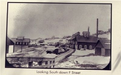
Virginia City in Storey County, Nevada — The American Mountains (Southwest)
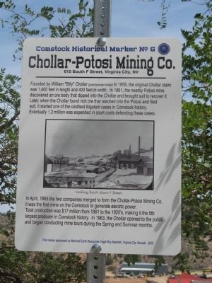
Chollar – Potosi Mining Co.
Comstock Historical Landmark No. 6
— 615 South F. Street, Virginia City, NV —
Founded by William “Billy” Chollar (pronounced collar) in 1859, the original Chollar claim was 1,400 feet in length and 400 feet in width. In 1861, the nearby Potosi mine discovered an ore body that dipped into Chollar and brought suit to recover it. Later, when Chollar found rich ore that reached into the Polosi and filed suit, it started one of the costliest litigation cases in Comstock history.
Eventually 1.3 million was expended in court costs defending these cases.
In April, 1865 the two companies merged to form the Chollar – Potosi Mining Co. It was the first mine on the Comstock to generate electric power.
Total production was $17 million from 1861 to the 1920’s, making it the 5th largest producer in Comstock history. In 1963, the Chollar opened to the public and began conducting mine tours during Spring and Summer months.
Erected 2009 by Marshall Earth Resources, Hugh Roy Marshall, Virginia City, Nevada. (Marker Number 6.)
Topics. This historical marker is listed in these topic lists: Natural Resources • Notable Buildings • Notable Places. A significant historical month for this entry is April 1865.
Location. 39° 18.186′ N, 119° 39.117′ W. Marker is in Virginia City, Nevada , in Storey County. Marker is on South D Street, on the right when traveling north. Marker is located at the Chollar Mansion at 565 South D Street. Touch for map. Marker is in this post office area: Virginia City NV 89440, United States of America. Touch for directions.
Other nearby markers. At least 8 other markers are within walking distance of this marker. Engineering Marvels on the Comstock (here, next to this marker); Fourth Ward School (within shouting distance of this marker); a different marker also named The Fourth Ward School (within shouting distance of this marker); Mackay Mansion (about 300 feet away, measured in a direct line); a different marker also named Mackay Mansion (about 300 feet away); Gould & Curry Offices (about 300 feet away); C. J. Prescott House (about 300 feet away); Combination Shaft (about 400 feet away). Touch for a list and map of all markers in Virginia City.
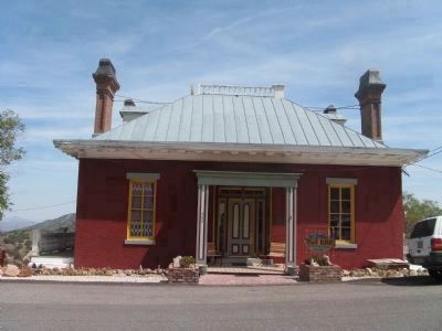
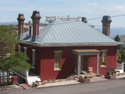
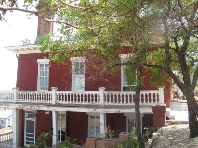
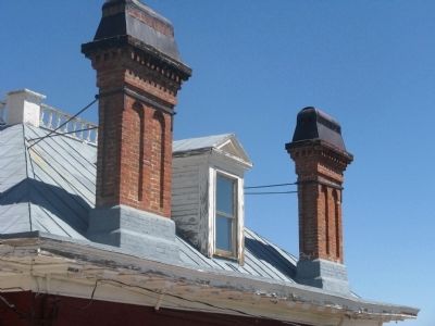
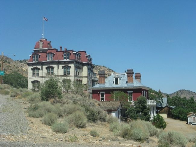
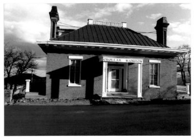
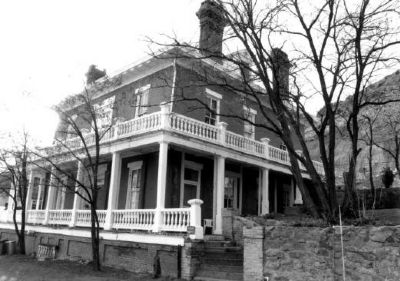
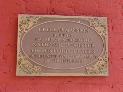
Regarding Chollar – Potosi Mining Co.. The Chollar Mansion was built in 1861, originally commissioned by Billy Chollar, the discoverer of the Chollar Silver Lode in 1861. Shortly thereafter, he lost both his mine and his home to the newly established Bank of California, and left Virginia City in 1862. The mansion served as the original business office of the Chollar Gold & Silver Mining Company until 1870, when it also became the mine superintendent's personal residence.
The Mansion is a Virginia City Landmark and was placed on the National Register
of Historic Places on August 5, 1993.
Also see . . . Chollar Mansion. Wikipedia entry (Submitted on March 13, 2021, by Larry Gertner of New York, New York.)
Additional keywords. Comstock Lode
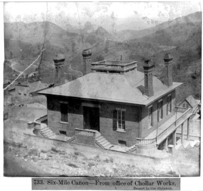
Photographed By Lawrence & Houseworth, publisher., circa 1866
11. Six Mile Canyon, From Office of Chollar Works - Desert in the Distance
Library of Congress Prints and Photographs Division
Click for more information.
Click for more information.
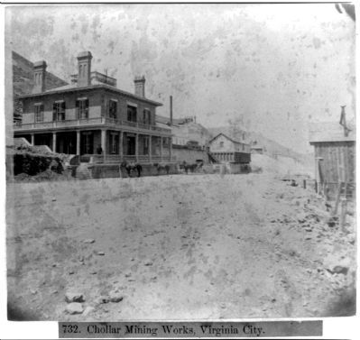
Photographed By Lawrence & Houseworth, publisher., circa 1866
12. Chollar Mining Works, Virginia City, Nevada
Library of Congress Prints and Photographs Division
Click for more information.
Click for more information.
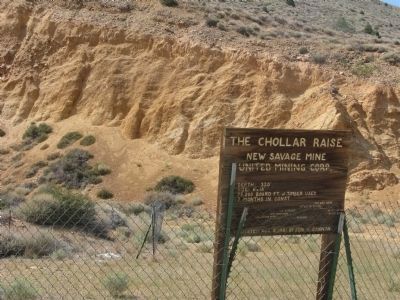
Photographed By Syd Whittle, August 9, 2009
13. The Chollar Raise
This marker is located directly across the street from the Fourth Ward School on C Street - West of Chollar Mansion:
Chollar Raise
New Salvage Mine
United Mining Corp.
Depth: 320', Size: 6' x 18'
75,000 Board Ft. of Timber Used
7 Months in Const.
Dedicated Aug.8, 1981 by Sen. H. Cannon
New Salvage Mine
United Mining Corp.
Depth: 320', Size: 6' x 18'
75,000 Board Ft. of Timber Used
7 Months in Const.
Dedicated Aug.8, 1981 by Sen. H. Cannon
Credits. This page was last revised on March 13, 2021. It was originally submitted on August 31, 2009, by Syd Whittle of Mesa, Arizona. This page has been viewed 2,030 times since then and 79 times this year. Photos: 1, 2, 3, 4, 5, 6, 7, 8, 9, 10, 11, 12, 13. submitted on August 31, 2009, by Syd Whittle of Mesa, Arizona.
