Near Fredericksburg in Stafford County, Virginia — The American South (Mid-Atlantic)
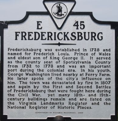
Fredericksburg
Erected 2003 by Department of Historic Resources. (Marker Number E-45.)
Topics. This historical marker is listed in this topic list: Settlements & Settlers. A significant historical year for this entry is 1728.
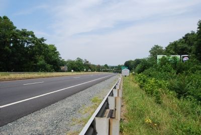
Location. 38° 18.314′ N, 77° 27.02′ W. Marker is near Fredericksburg, Virginia, in Stafford County. Marker is on Kings Highway (Business Virginia Route 3) 0.1 miles east of Virginia Route 218, on the right when traveling west. Touch for map. Marker is at or near this postal address: 207 Riverview Dr, Fredericksburg VA 22405, United States of America. Touch for directions.
Other nearby markers. At least 8 other markers are within walking distance of this marker. Chatham (about 600 feet away, measured in a direct line); Fredericksburg and Spotsylvania National Military Park (approx. 0.3 miles away); a different marker also named Chatham (approx. 0.3 miles away); Beyond the Big House (approx. 0.3 miles away); Chatham and the Civil War (approx. 0.3 miles away); a different marker also named Chatham (approx. 0.3 miles away); A Changed Landscape (approx. 0.4 miles away); Sow…Tend…Harvest (approx. 0.4 miles away). Touch for a list and map of all markers in Fredericksburg.
Regarding Fredericksburg. A 1930s or 1940s marker with this same title and number stood a bit south of here near the bridge to Fredericksburg on what was then U.S. Route 1. It read, “A settlement was made here at an early period. The town was established in 1727 and was named for Prince Frederick, father of George III.”
Credits. This page was last revised on February 2, 2023. It was originally submitted on July 14, 2007, by Dawn Bowen of Fredericksburg, Virginia. This page has been viewed 1,330 times since then and 28 times this year. Last updated on August 30, 2007. Photos: 1, 2. submitted on July 14, 2007, by Dawn Bowen of Fredericksburg, Virginia. • J. J. Prats was the editor who published this page.

