Near Boise in Ada County, Idaho — The American West (Mountains)
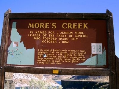
More's Creek
Like most of Idaho's early miners, he came originally from the South. Unlike most of them, he struck it rich. During the Idaho gold rush, he had profitable investments in many important mining camps. Hardly anyone else did as much to build Idaho during the early days.
Erected by Idaho Historical Society. (Marker Number 318.)
Topics and series. This historical marker is listed in this topic list: Settlements & Settlers. In addition, it is included in the Idaho State Historical Society series list. A significant historical month for this entry is October 1791.
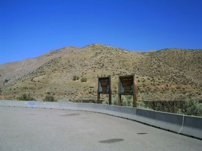
Location. 43° 35.466′ N, 115° 59.92′ W. Marker is near Boise, Idaho, in Ada County. Marker is on State Highway 21 at milepost 17,, 0.2 miles south of Arrowrock Road, on the right when traveling north. Touch for map. Marker is in this post office area: Boise ID 83716, United States of America. Touch for directions.
Other nearby markers. At least 8 other markers are within 7 miles of this marker, measured as the crow flies. Arrowrock Dam (here, next to this marker); The Old Toll Road (approx. 2˝ miles away); The Foote Legacy in Idaho (approx. 5.6 miles away); Beaver Dick's Ferry (approx. 5.7 miles away); The Oregon Trail (approx. 5.7 miles away); Diversion Dam (approx. 5.9 miles away); a different marker also named Diversion Dam (approx. 6 miles away); Fort Boise (approx. 6˝ miles away). Touch for a list and map of all markers in Boise.
Credits. This page was last revised on June 16, 2016. It was originally submitted on September 20, 2009, by Rebecca Maxwell of Boise, Idaho. This page has been viewed 1,386 times since then and 19 times this year. Photos: 1, 2. submitted on September 20, 2009, by Rebecca Maxwell of Boise, Idaho. • Craig Swain was the editor who published this page.

