Near Van Wyck in Lancaster County, South Carolina — The American South (South Atlantic)
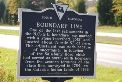
Boundary Line
Erected 1983 by Lancaster County Historical Commission. (Marker Number 29-14.)
Topics. This historical marker is listed in these topic lists: Landmarks • Political Subdivisions. A significant historical year for this entry is 1764.
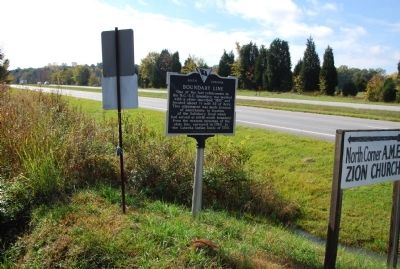
Location. 34° 49.656′ N, 80° 48.21′ W. Marker is near Van Wyck, South Carolina, in Lancaster County. Marker is at the intersection of Charlotte Highway (U.S. 521) and East North Corner Road, on the left when traveling south on Charlotte Highway. Touch for map. Marker is in this post office area: Van Wyck SC 29744, United States of America. Touch for directions.
Other nearby markers. At least 8 other markers are within walking distance of this marker. Birthplace of Andrew Jackson (approx. 0.6 miles away); Major Crawford's Home (approx. ¾ mile away); Jackson Comes Home (approx. 0.9 miles away); The Boy of the Waxhaws (approx. 0.9 miles away); Birthplace of Andrew Jackson Monument (approx. 0.9 miles away); Welcome to the Andrew Jackson State Park Museum (approx. 0.9 miles away); Heart of the Community (approx. 0.9 miles away); Welcome to Andrew Jackson State Park (approx. 0.9 miles away). Touch for a list and map of all markers in Van Wyck.
Also see . . .
1. National Register of Historic Places nomination form for the boundary marker. (Submitted on November 3, 2009, by Michael Sean Nix of Spartanburg, South Carolina.)
2. South Carolina Department of Archives and History. (Submitted on November 3, 2009, by Michael Sean Nix of Spartanburg, South Carolina.)

South Carolina Department of Archives and History
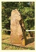
4. Boundary Line Marker
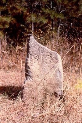
According to the National Register of Historic Places nomination form, part of the stone marker's top was knocked off when a car hit it. In addition, the stone marker currently reads 1818 because of vandalism. These changes are noted in the nomination form.
Credits. This page was last revised on June 16, 2016. It was originally submitted on October 29, 2009, by Michael Sean Nix of Spartanburg, South Carolina. This page has been viewed 1,541 times since then and 54 times this year. Photos: 1, 2, 3. submitted on October 29, 2009, by Michael Sean Nix of Spartanburg, South Carolina. 4. submitted on November 3, 2009, by Michael Sean Nix of Spartanburg, South Carolina. • Kevin W. was the editor who published this page.


