Harding in Morris County, New Jersey — The American Northeast (Mid-Atlantic)
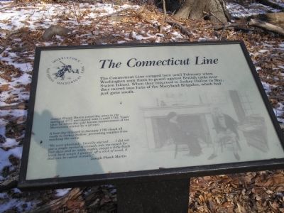
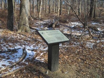
The Connecticut Line
Morristown National Historical Park
Joseph Plumb Martin joined the army in the spring of 1777 and stayed with it until 1783. Years later he wrote the only known reminiscences of the Morristown winter by a private.
A four-day blizzard in January 1780 closed all roads to Jockey Hollow, preventing supplies from reaching the camp.
“We were absolutely, literally starved . . . I did not put a single morsel of victuals into my mouth for four days and as many nights, except a little black birch bark which I gnawed off a stick of wood, if that can be called victuals.”
Erected by Morristown National Historical Park.
Topics. This historical marker is listed in this topic list: War, US Revolutionary. A significant historical month for this entry is January 1780.
Location. 40° 45.623′ N, 74° 32.369′ W. Marker is in Harding, New Jersey, in Morris County. Marker can be reached from Jockey Hollow Road, on the left when traveling south. Marker is located in the Jockey Hollow Unit of Morristown National Historical Park, on the Grand Loop Trail, just north of the Mendham Road Trail. Touch for map. Marker is in this post office area: Morristown NJ 07960, United States of America. Touch for directions.
Other nearby markers. At least 8 other markers are within walking distance of this marker. Hand’s Brigade (approx. 0.2 miles away); The Aqueduct Trail (approx. 0.2 miles away); Captain Adam Bettin (approx. 0.2 miles away); Roads (approx. 0.2 miles away); The Wick Farm (approx. ¼ mile away); a different marker also named The Wick Farm (approx. ¼ mile away); Wick Farm Garden (approx. 0.3 miles away); The Second Maryland Brigade (approx. half a mile away). Touch for a list and map of all markers in Harding.
Also see . . . Morristown National Historical Park. National Park Service website. (Submitted on December 14, 2009, by Bill Coughlin of Woodland Park, New Jersey.)
Credits. This page was last revised on June 16, 2016. It was originally submitted on December 14, 2009, by Bill Coughlin of Woodland Park, New Jersey. This page has been viewed 896 times since then and 33 times this year. Photos: 1, 2, 3, 4. submitted on December 14, 2009, by Bill Coughlin of Woodland Park, New Jersey.


