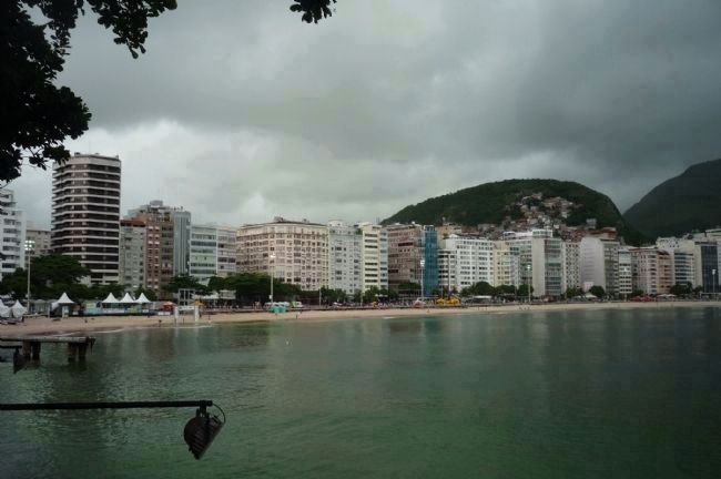
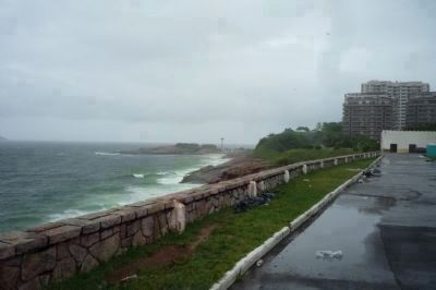
Copacabana in Rio de Janeiro, Brazil — Southeast Region (Coastal)
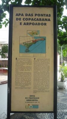
APA das Pontas de Copacabana e Arpoador
Environmental Protection Area of Copacabana and Arpoador Promontories
Inscription.
[The text on the right of the marker is in English]:
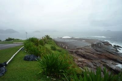
The Environmental Protection Area (APA) of Copacabana and Arpoador Promontories was created by Municipal Law No. 2.087/94 to protect its rocky coast and native plant life species. The APA has the Copacabana Fort and the “Girl from Ipanema” Park as its limits.
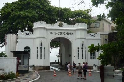
The Copacabana Fort had its construction finished in 1914 with a mission to protect Rio de Janeiro’s coast. Today the fort shelters the Historic Army Museum which provides visitors educational and cultural activities. In the past, at the very end of Arpoador Promontory - the Arpoador Rock - fishermen used to harpoon the whales that came to reproduce in this warm waters. The harpoon used by those fishermen gave them the name also has been used to identify the rock (in Portuguese, Arpoador means fisherman who uses a harpoon). The Arpoador Rock is preserved by the Municipal Historic Heritage. Also within the APA limits is a public square called “Girl from Ipanema Park” after the world famous music composed by Vinicius de Moraes and Tom Jobim. In 1995 the Marechal Rondon Cyclelane was opened connecting Ipanema and Copacabana neighborhoods. Together with these attractions, the natural beauty of this area turns it into a main tourist and leisure point.
Visiting Hours
[A diagram of the promontories is at the top of the marker. The left side marker narrative is in Portuguese]:
Esta Área de Proteção Ambiental foi criada através da Lei Municipal nº 2.087/94, com o objetivo de proteger o costão rochosa e sua vegetação caracteristica localizada entre as Pontas de Copacabana e Arpoador. E limitado pelo Forte de Copacabana e pelo Parque Garota de Ipanema.
O Forte de Copacabana, inaugurado em 1914 com o objetivo de proteger a barra do Rio de Janeiro, abriga atualmenteo a Museu Histórico do Exército, que oferece ao público educacionais e culturais.
A Pedra do Arpoador, tombada pela Lei nº 1.433/89, deve seu com nome ao arpão usado por pescadores na pesca de baleias que vinham se reproduzir em suas águas. A Praça do Arpoador, conhecida eplo nome aroginal de Garota de Ipanema, Homenageia a famosa música de Vinicius de Morais e Tom Jobim. Em 1995, foi inaugurada a ciclovia Marechal Rondon, liga os bairros de Ipanema e Copacabana. Esta é uma das várias atrações da APA, que além de suas belezas naturais, constitui uma importante área turistica e de lazer para a população.
Visitação
Área De Proteçâo Ambiental
Lei Municipal No. 2.087/94
Erected by
Prefeitura Rio: Cidade Maravilhosa, Secretaria Municipal De Meio Ambiente.
Topics. This historical marker is listed in these topic lists: Arts, Letters, Music • Forts and Castles • Natural Resources. A significant historical year for this entry is 1914.
Location. 22° 59.188′ S, 43° 11.299′ W. Marker is in Rio de Janeiro. It is in Copacabana. Marker can be reached from the Forte de Copacabana access road east of Avenida Atlântica. Marker is at the main entrance to the fort at the south end of Copacabana Beach, north of the Environmental Protection Area and Rua Garota de Ipanema. Touch for map. Marker is at or near this postal address: Praça Cel Eugênio Franco 2, Rio de Janeiro 22070-020, Brazil. Touch for directions.
Other nearby markers. At least 8 other markers are within 10 kilometers of this marker, measured as the crow flies. Copacabana Fort (within shouting distance of this marker); Augusto Ferreira Ramos (approx. 4.6 kilometers away); Christ the Redeemer Monument (approx. 5.2 kilometers away); CCAPA (approx. 5.3 kilometers away); Cristovão Leite de Castro (approx. 5.3 kilometers away); Ordem Terceira do Carmo Church (approx. 9.4 kilometers away); Praça 15 de Novembro (approx. 9.4 kilometers away); João Cândido Felisberto Memorial (approx. 9.5 kilometers away). Touch for a list and map of all markers in Rio de Janeiro.
Also see . . . "The Girl from Ipanema". ("Garota de Ipanema") is a well-known bossa nova song, a worldwide hit
in the mid-1960s that won a Grammy for Record of the Year in 1965. It was written in 1962, with music by Antonio Carlos Jobim and Portuguese lyrics by Vinicius de Moraes with English lyrics written later by Norman Gimbel. (Submitted on December 27, 2009, by Richard E. Miller of Oxon Hill, Maryland.)
Additional keywords. Brasil; Bahia de Guanabara; coastal artillery.
Credits. This page was last revised on January 31, 2023. It was originally submitted on December 27, 2009, by Richard E. Miller of Oxon Hill, Maryland. This page has been viewed 2,983 times since then and 9 times this year. Photos: 1, 2, 3, 4, 5. submitted on December 27, 2009, by Richard E. Miller of Oxon Hill, Maryland. • Kevin W. was the editor who published this page.
