Near Lolo Summit in Idaho County, Idaho — The American West (Mountains)
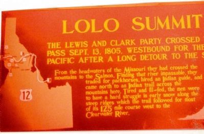
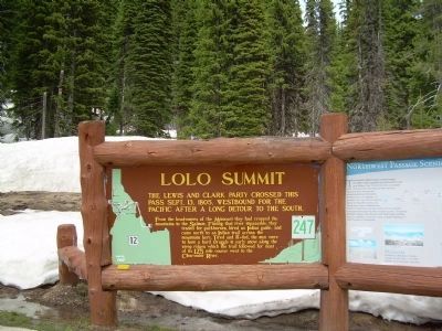
Lolo Summit
From the headwaters of the Missouri they had crossed the mountains to the Salmon. Finding that river impassable, they traded for pack horses, hired an Indian guide, and came north to an Indian trail across the mountains here. Tired and ill-fed, the men were to have a hard struggle in early snow along the steep ridges which the trail followed for most of the 125 mile course west to the Clearwater River.
Erected by Idaho Historical Society. (Marker Number 247.)
Topics and series. This historical marker is listed in this topic list: Exploration. In addition, it is included in the Idaho State Historical Society, and the Lewis & Clark Expedition series lists. A significant historical month for this entry is September 1752.
Location. 46° 38.118′ N, 114° 34.668′ W. Marker is near Lolo Summit, Idaho, in Idaho County. Marker is on Elk Meadows Road near U.S. 12. Located at the Lolo Summit Visitor Center on the Idaho/Montana border. Touch for map. Marker is in this post office area: Elk City ID 83525, United States of America. Touch for directions.
Other nearby markers. At least 8 other markers are within 11 miles of this marker, measured as the crow flies. Lewis and Clark (within shouting distance of this marker); Nez Perce Trail (about 300 feet away, measured in a direct line); Lewis and Clark Route (approx. 1.1 miles away); Lolo Trail Crossing (approx. 2.9 miles away); Checkerboard Legacy (approx. 2.9 miles away); Soldiers as Naturalists (approx. 8.1 miles away in Montana); Cycles and Circles (approx. 10.7 miles away in Montana); a different marker also named Lewis and Clark Route (approx. 10.9 miles away).
Credits. This page was last revised on June 16, 2016. It was originally submitted on February 2, 2010, by Lila Diller of Statesville, North Carolina. This page has been viewed 1,650 times since then and 79 times this year. Photos: 1. submitted on February 2, 2010, by Lila Diller of Statesville, North Carolina. 2. submitted on May 18, 2014, by Doreen Thomson of Calgary, Alberta Canada. • Kevin W. was the editor who published this page.

