Near Murrells Inlet in Horry County, South Carolina — The American South (South Atlantic)
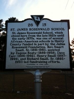
St. James Rosenwald School
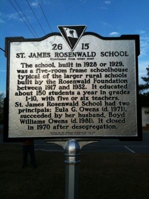
Marker Reverse:
The school, built in 1928 or 1929, was a five-room frame schoolhouse typical of the larger rural schools built by the Rosenwald Foundation between 1917 and 1932. It educated about 150 students a year in grades 1-10, with five or six teachers. St. James Rosenwald School had two principals: Eula G. Owens (d. 1971), succeeded by her husband, Boyd Williams Owens (d. 1981). It closed in 1970 after desegregation.
Erected 2005 by the Burgess Organization for the Advancement of Young People, Inc. (Marker Number 26-15.)
Topics and series. This historical marker is listed in these topic lists: African Americans • Education. In addition, it is included in the Rosenwald Schools series list. A significant historical year for this entry is 1928.
Location. 33° 37.273′ N, 79° 2.513′ W. Marker is near Murrells Inlet , South Carolina, in Horry County. Marker is on State Highway 707, 0.2 miles south of McDowell Short Cut Road (State Highway 477), on the right when traveling north. Marker is on SC 707 at 10299 (Burgess Community Center) approximately 3 miles NW of US17. Touch for map. Marker is in this post office area: Murrells Inlet SC 29576, United States of America. Touch for directions.
Other nearby markers. At least 8 other markers are within 5 miles of this marker, measured as the crow flies. Ark Cemetery (approx. 3.8 miles away); Ark Agriculture (approx. 3.9 miles away); The Ark House and Shady Side Inn (approx. 3.9 miles away); 1838 Ark Land Survey (approx. 3.9 miles away); The Ark Sand Ridge (approx. 3.9 miles away); Ark Plantation (approx. 3.9 miles away); Surfside Beach Veterans Monument (approx. 4 miles away); Murrells Inlet Boat Captains (approx. 4˝ miles away).
Credits. This page was last revised on June 16, 2016. It was originally submitted on February 9, 2010, by David Bullard of Seneca, South Carolina. This page has been viewed 1,181 times since then and 32 times this year. Photos: 1, 2, 3. submitted on February 9, 2010, by David Bullard of Seneca, South Carolina. • Kevin W. was the editor who published this page.


