Near Mechanicsburg in Boone County, Indiana — The American Midwest (Great Lakes)
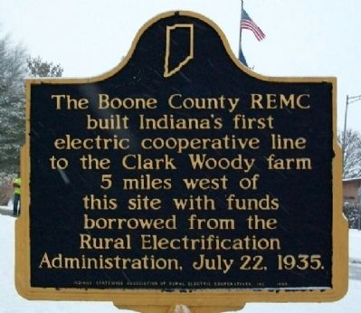
Boone County REMC
Erected 1985 by Indiana Statewide Association of Rural Electric Cooperatives, Inc. (Marker Number 06.1985.1.)
Topics and series. This historical marker is listed in these topic lists: Charity & Public Work • Industry & Commerce. In addition, it is included in the Indiana Historical Bureau Markers, and the Rural Electrification 💡 series lists. A significant historical date for this entry is July 22, 1900.
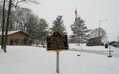
Location. 40° 9.471′ N, 86° 32.296′ W. Marker is near Mechanicsburg, Indiana, in Boone County. Marker is at the northbound I-65 Lebanon Rest Area (near milepost 150) just south of the Clinton County-Boone County line, about 100 feet east of the convenience station. Touch for map. Marker is in this post office area: Lebanon IN 46052, United States of America. Touch for directions.
Other nearby markers. At least 8 other markers are within 9 miles of this marker, measured as the crow flies. Indian Cemetery (approx. 3.6 miles away); Sugar Creek Community (approx. 4.7 miles away); Boone County Veterans Memorial (approx. 7.8 miles away); Samuel M. Ralston (approx. 8˝ miles away); Revolutionary War Memorial (approx. 8˝ miles away); Boone County (Indiana) Veterans (approx. 8˝ miles away); Abraham Lincoln (approx. 8.6 miles away); Clinton County Veterans Memorial (approx. 8.6 miles away).
Credits. This page was last revised on January 5, 2020. It was originally submitted on February 18, 2010, by William Fischer, Jr. of Scranton, Pennsylvania. This page has been viewed 2,038 times since then and 25 times this year. Photos: 1, 2. submitted on February 19, 2010, by William Fischer, Jr. of Scranton, Pennsylvania.

