Falls Church, Virginia — The American South (Mid-Atlantic)
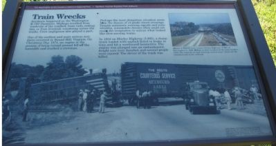
Train Wrecks
One of the earliest and most serious accidents occurred in Round Hill, Virginia. On Christmas Day 1874, an engine in the process of being turned around fell off the turntable and crushed a crewman.
Perhaps the most dangerous situation arose from dozens of at-grade street crossings. Despite automatic warning signals and train whistles, automobile drivers often could not resist the temptation to outrun what looked like slow-moving trains.
In 1952 on Shirley Highway (I-395), a dump truck loaded with asphalt failed to brake in time and hit a westbound locomotive. The engine was plunged into an embankment, freight cars were derailed, and several people were injured. The driver of the truck was killed.
Erected by The Washington & Old Dominion Railroad Regional Park, Northern Virginia Regional Park Authority.
Topics and series. This historical marker is listed in this topic list: Railroads & Streetcars. In addition, it is included in the NOVA Parks, and the Washington and Old Dominion (W&OD) Railroad series lists. A significant historical year for this entry is 1874.
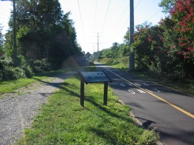
Location. Marker has been reported missing. It was located near 38° 53.443′ N, 77° 10.654′ W. Marker was in Falls Church, Virginia. Marker was on North Oak Street, on the right when traveling south. Just to the west of the Oak Street crossing of the W&OD Railroad Trail. Touch for map. Marker was in this post office area: Falls Church VA 22046, United States of America. Touch for directions.
Other nearby markers. At least 8 other markers are within walking distance of this location. DePutron House (approx. ¼ mile away); Living in Fear (approx. 0.3 miles away); Original Federal Boundary Stone, District of Columbia, West Cornerstone (approx. 0.3 miles away); West Falls Church Station (approx. 0.4 miles away); Tracks into History (approx. 0.4 miles away); This is the W&OD Trail! (approx. 0.4 miles away); Mt. Hope (approx. 0.4 miles away); Hangman's Tree (approx. 0.4 miles away). Touch for a list and map of all markers in Falls Church.
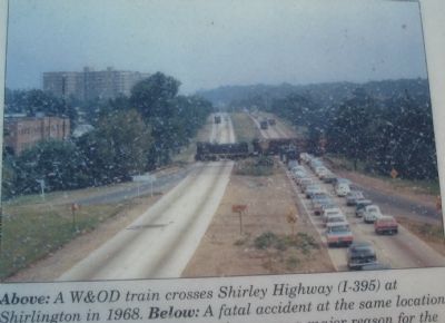
More about this marker. This marker is duplicated at different points along the trail. A smaller inset photograph shows "A W&OD train crosses Shirley Highway (I-395) at Shirlington in 1868." The background photo of the accident from 1952 is captioned, "A fatal accident at the same location in 1952. The hazards of road crossings were a major reason for the abandonment of the railroad."
Also see . . .
1. The Washington and Old Dominion Railroad. Book by Ames Williams available on Amazon.com (Submitted on May 7, 2008, by Tom Fuchs of Greenbelt, Maryland.)
2. Rails to the Blue Ridge: The Washington and Old Dominion Railroad, 1847 - 1968. Book by Herbert Harwood available on Amazon.com (Submitted on May 7, 2008, by Tom Fuchs of Greenbelt, Maryland.)
Credits. This page was last revised on January 22, 2023. It was originally submitted on October 10, 2007, by Craig Swain of Leesburg, Virginia. This page has been viewed 3,593 times since then and 21 times this year. Photos: 1, 2, 3. submitted on October 10, 2007, by Craig Swain of Leesburg, Virginia.


