Perrysburg in Wood County, Ohio — The American Midwest (Great Lakes)
Perrysburg / Perrysburg Plat Map
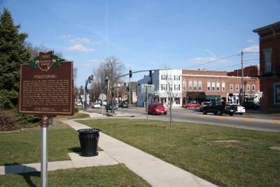
[West Side of Marker] : "Perrysburg"
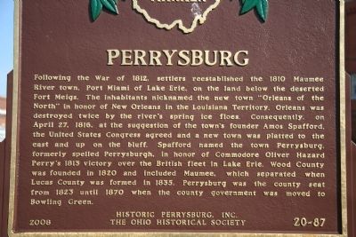
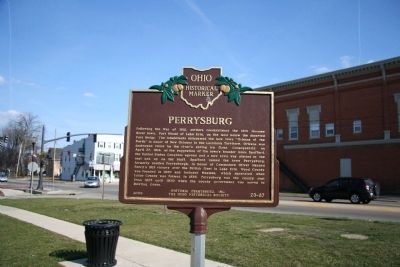
Following the War of 1812, settlers reestablished the 1810 Maumee River town, Port Miami of Lake Erie, on the land below the deserted Fort Meigs. The inhabitants nicknamed the new town "Orleans of the North" in honor of New Orleans in the Louisiana Territory. Orleans was destroyed twice by the river's spring ice floes. Consequently, on April 27, 1816, at the suggestion of the town's founder Amos Spafford, the United States Congress agreed and a new town was platted to the east and up on the bluff. Spafford named the town Perrysburg, formerly spelled Perrysburgh, in honor of Commodore Oliver Hazard Perry's 1813 victory over the British fleet in Lake Erie. Wood County was founded in 1820 and included Maumee, which separated when Lucas County was formed in 1835. Perrysburg was the county seat from 1823 until 1870 when the county government was moved to Bowling Green.
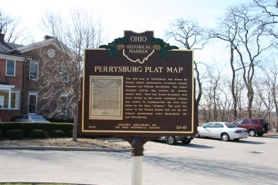
[East Side of Marker] : "Perrysburg Plat Map"
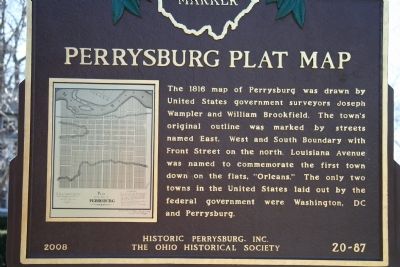
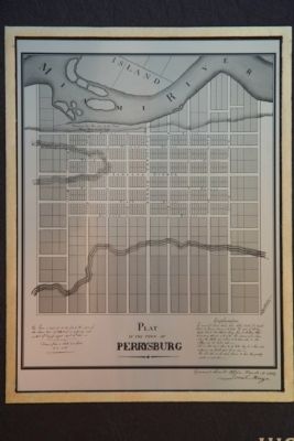
[PLAT MAP] The 1816 map of Perrysburg was drawn by United States government surveyors Joseph Wampler and William Brookfield. The town's original outline was marked by streets named East, West and South Boundary with Front Street on the north. Louisiana Avenue was named to commemorate the first town down on the flats, "Orleans." The only two towns in the United States laid out by the federal government were Washington, DC and Perrysburg.
Erected 2008 by Historic Perrysburg, Inc. and The Ohio Historical Society. (Marker Number 20-87.)
Topics and series. This historical marker is listed in this topic list: Settlements & Settlers. In addition, it is included in the Ohio Historical Society / The Ohio History Connection series list. A significant historical month for this entry is April 1836.
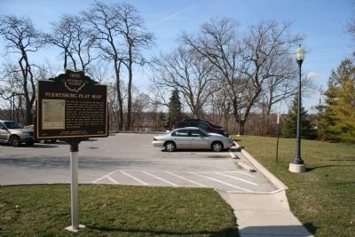
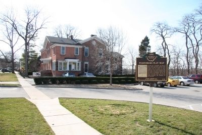
Location. 41° 33.62′ N, 83° 37.839′ W. Marker is in Perrysburg, Ohio, in Wood County. Marker is on West Front Street (Ohio Route 65) west of Louisiana Avenue, on the right when traveling west. The historical marker is located on the river side of West Front Street, beside the Hood Park parking lot. Touch for map. Marker is at or near this postal address: 111 West Front Street, Perrysburg OH 43551, United States of America. Touch for directions.
Other nearby markers. At least 8 other markers are within walking distance of this marker. Perrysburg World War Memorial (a few steps from this marker); Fort Meigs Directional Marker (a few steps from this marker); Perrysburg Veterans Memorial (within shouting distance of this marker); Commodore Oliver Hazard Perry (within shouting distance of this marker); World War I Veterans' Memorial (within shouting distance of this marker); Soldiers and Sailors Memorial (within shouting distance of this marker); History Happened Here (within shouting distance of this marker); History Happens Here… (about 300 feet away, measured in a direct line). Touch for a list and map of all markers in Perrysburg.
Regarding Perrysburg / Perrysburg Plat Map. According to the information contained in the text of this marker it was on, "April 27, 1816, at the suggestion of the town's founder Amos Spafford, (that) the United States Congress agreed and a new town was platted ..." The text on the marker goes on to state that, "Spafford named the town Perrysburg ..."
The marker also displays a copy of the 1816, "Perrysburg Plat Map," that showed the town's original outline. So it should come as no surprise that in 2016 the residents of Perrysburg are preparing to celebrate the community's 200th birthday.
However, in the April 10, 2016 edition of "The Blade" newspaper (see link to article) several "facts" regarding the origins of Perrysburg were called into question, including the one stated in the very last sentence on this OHS marker. That sentence reads: "The only two towns in the United States laid out by the federal government were Washington, DC and
Perrysburg."
According to "The Blade" article, "Mr. Call and Mr. Franks, however, read letters of the government surveyors and discovered that along with Perrysburg, the men were assigned to plat Croghansville, which is now Fremont, after Perrysburg. That led the researchers to Fremont to discover it was also platted by the federal government, adding to the list of communities with the designation."
This challenge to the "facts" of Perrysburg's origins of course has both its supporters and its detractors. "The Blade" news article reads that "Local historians said the discovery was news to them." and goes on to state that, "Way Public Library’s Richard Baranowski is skeptical about the new information. He has done his own research and still believes that Washington and Perrysburg are the only two laid out by the federal government."
So as of this writing, a verdict has not yet been reached regarding what version of the "truth" will be shared during Perrysburg's 200th birthday party on April 27th of 2016, or how these new revelations of "fact" will impact the fate of this featured historical marker.
Also see . . . Perrysburg Abounds in History. Historic Perrysville website homepage (Submitted on July 26, 2022, by Larry Gertner of New York, New York.)
Credits. This page was last revised on July 26, 2022. It was originally submitted on April 7, 2010, by Dale K. Benington of Toledo, Ohio. This page has been viewed 1,569 times since then and 50 times this year. Photos: 1, 2, 3, 4, 5, 6, 7, 8. submitted on April 7, 2010, by Dale K. Benington of Toledo, Ohio.
