Ridgefield in Fairfield County, Connecticut — The American Northeast (New England)
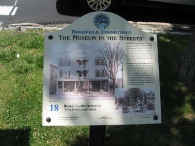
Bissell's – Destroyed by Two Conflagrations
Ridgefield, Connecticut
— The Museum in the Streets —
Hiram K. Scott set up the town's first variety and drug store in 1853. Scott was an influential businessman, serving as postmaster, town clerk, probate judge and a druggist for 50 years. He sold his store to Harvey Bissell in the summer of 1895, just six months before the Great Fire destroyed the building. Bissell rebuilt the following year and the drugstore continued in business until, in 2005 it once again burned to the ground. Bissell's lives on although it has moved a half block to the east.
The Ridgefield Savings Bank and First National Bank have had several homes and names. For many years each had their offices in the first floor of the Town Hall. In 1911 the First National Bank, which was formed in 1900, moved to the corner of Main and Governor Streets. The Ridgefield Savings Bank was organized in 1871 by a group of local merchants and businessmen. Its first office was in the building known as "Old Hundred" (see plaque #22). In 1930 its new art deco building was erected at its present site at 374 Main Street, replacing the tenement house seen in the photo.
Erected 2008 by The Museum in the Streets®. (Marker Number 18.)
Topics and series. This historical marker is listed in these topic lists: Architecture • Industry & Commerce. In addition, it is included in the Art Deco, and the The Museum in the Streets®: Ridgefield, Connecticut series lists. A significant historical year for this entry is 1853.
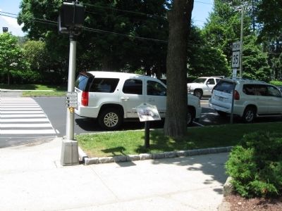
Location. 41° 16.825′ N, 73° 29.895′ W. Marker is in Ridgefield, Connecticut, in Fairfield County. Marker is at the intersection of Governor Street and Main Street (Connecticut Route 35), on the right when traveling west on Governor Street. Touch for map. Marker is in this post office area: Ridgefield CT 06877, United States of America. Touch for directions.
Other nearby markers. At least 8 other markers are within walking distance of this marker. The Original Episcopal Church (within shouting distance of this marker); The First Society of Ridgefield (within shouting distance of this marker); The Village Center in the Early 1900s (within shouting distance of this marker); More of the Great Fire (within shouting distance of this marker); The Confederate Bell (about 300 feet away, measured in a direct line); Ridgefield Veterans Memorial (about 300 feet away); The Lounsbury House (about 300 feet away); The Great Fire of 1895 (about 400 feet away). Touch for a list and map of all markers in Ridgefield.
Credits. This page was last revised on August 7, 2023. It was originally submitted on June 6, 2010, by Michael Herrick of Southbury, Connecticut. This page has been viewed 944 times since then and 31 times this year. Photos: 1, 2. submitted on June 6, 2010, by Michael Herrick of Southbury, Connecticut.

