Near Prospect in Prince Edward County, Virginia — The American South (Mid-Atlantic)
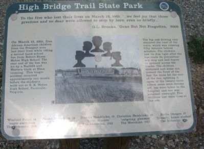
High Bridge Trail State Park
Elam Crossing
G.L. Brooks, "Gone But Not Forgotten," 2009
On March 13, 1951, five African American children from the Prospect area lost their lives while riding a second-hand school bus from Robert Russa Moton High School. The rear end of the bus was hit by a Norfolk and Western train at Elam crossing. This tragic accident occurred approximately one month before the student's walk-out at R.R. Moton High School, Farmville, Virginia.
The fog and driving rain obscured the view of the train, which was running fifty minutes behind schedule. The students saw its dim light after the bus made its precautionary stop and had begun to proceed across the tracks. The children screamed and some ran toward the front of the bus; the train hit the rear of the bus, splitting it open; of the twenty-three riders, some were thrown off, ten were taken to the hospital, and one was retained overnight. Five children lost their lives at the site.
Winfield Paige, 14
"eager ambitious"
The Motonian, 1951
Naomi Hendricks, 18
"chearful, ambitious"
The Motonian, 1951
Dodson Hendricks, 15
"quiet, sincere"
The Motonian, 1951
Christine Hendricks, 18
"outgoing, pleasant"
The Motonian, 1951
Hettie Dungee, 17
"friendly, honor student"
The Motonian, 1951
Topics. This historical marker is listed in these topic lists: African Americans • Railroads & Streetcars. A significant historical month for this entry is March 1810.
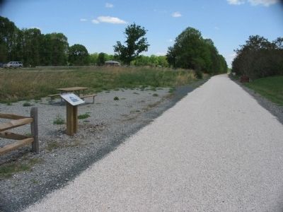
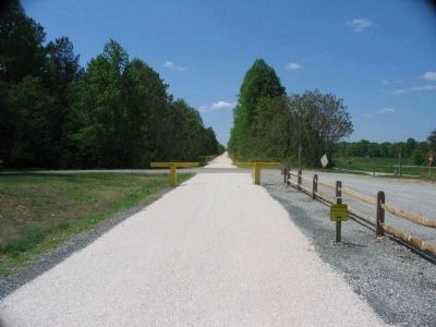
Location. 37° 17.048′ N, 78° 37.023′ W. Marker is near Prospect, Virginia, in Prince Edward County. Marker is at the intersection of County Route 657 and Prince Edward Highway (U.S. 460), on the right when traveling north on County Route 657. Located along the High Bridge railroad trail, on the old railroad bed. Touch for map. Marker is in this post office area: Prospect VA 23960, United States of America. Touch for directions.
Other nearby markers. At least 8 other markers are within 9 miles of this marker, measured as the crow flies. Sulphur Spring Baptist Church (approx. 1.7 miles away); Appomattox County / Prince Edward County (approx. 3.7 miles away); Clay Smoking Pipes (approx. 3.9 miles away); Vernon Johns (approx. 6˝ miles away); About Hampden-Sydney College (approx. 9 miles away); Hampden-Sydney College (approx. 9 miles away); Hampden-Sydney (approx. 9 miles away); Everett Stadium (approx. 9.1 miles away).
Credits. This page was last revised on June 16, 2016. It was originally submitted on June 11, 2010, by Craig Swain of Leesburg, Virginia. This page has been viewed 1,144 times since then and 33 times this year. Photos: 1, 2, 3. submitted on June 11, 2010, by Craig Swain of Leesburg, Virginia.


