Beatty in Nye County, Nevada — The American Mountains (Southwest)
Beatty
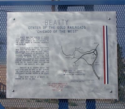
Center of the Gold Railroads
— "Chicago of the West" —
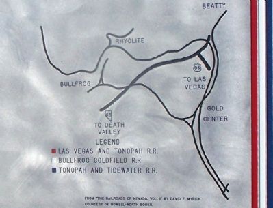
During 1906-'07 three railroads were built in this area. The Las Vegas and Tonopah built from Las Vegas through Beatty and Rhyolite to Goldfield. The Bullfrog Goldfield built south from Goldfield to Beatty and Rhyolite. The Tonopah and Tidewater built north from Ludlow, California to Gold Center and used the BG tracks from Gold Center to Beatty and Rhyolite until 1914.
Rancher M.M. Beatty drove the last spike here on April 18, 1907, marking the completion of the first and only north-south railroad system in the state.
Rails were torn up at Beatty beginning on July 18, 1942.
Erected 2008 by Nevada State Park System, Beatty Lions Club for Frank Brockman. (Marker Number 173.)
Topics. This historical marker is listed in these topic lists: Industry & Commerce • Notable Places • Railroads & Streetcars. A significant historical month for this entry is April 1827.
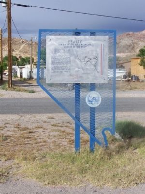
Location. 36° 54.357′ N, 116° 45.341′ W. Marker is in Beatty, Nevada, in Nye County. Marker is on U.S. 95, on the left when traveling south. Located Between West Amargosa and Valley Streets. Touch for map. Marker is in this post office area: Beatty NV 89003, United States of America. Touch for directions.
Other nearby markers. At least 8 other markers are within 5 miles of this marker, measured as the crow flies. 1921 Fordson Tractor (approx. 0.3 miles away); Desert Hills Cemetery (approx. half a mile away); Rhyolite Train Depot (approx. 4.1 miles away); Cook Bank Building (approx. 4.1 miles away); Rhyolite (approx. 4.1 miles away); Tom Kelly Bottle House (approx. 4.1 miles away); Welcome to Rhyolite (approx. 4.1 miles away); Rhyolite's District of Shadows (approx. 4.2 miles away). Touch for a list and map of all markers in Beatty.
Also see . . . New Amended Text for Marker. The Nevada State Historic Preservation Office (SHPO) recently updated the text of the roughly 260 state historical markers in Nevada. The Nevada SHPO placed the amended text of each individual marker on its website and will change the actual markers in the field as funding allows. Minor changes have been made to the marker for grammar and readability. The link will take you to the Nevada SHPO page for the marker with the amended text. (Submitted on November 12, 2013, by Duane Hall of Abilene, Texas.)
Credits. This page was last revised on October 28, 2023. It was originally submitted on June 16, 2010, by Mike Stroud of Bluffton, South Carolina. This page has been viewed 1,062 times since then and 52 times this year. Photos: 1, 2, 3, 4. submitted on June 16, 2010, by Mike Stroud of Bluffton, South Carolina. 5. submitted on November 10, 2020, by Craig Baker of Sylmar, California. 6. submitted on October 8, 2015, by Trev Meed of Round Mountain, Nevada. 7, 8, 9, 10. submitted on October 12, 2015, by Trev Meed of Round Mountain, Nevada.
