Belmont in Lafayette County, Wisconsin — The American Midwest (Great Lakes)
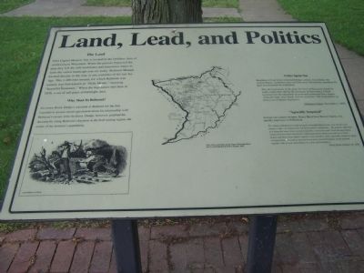
Land, Lead, and Politics
The Land
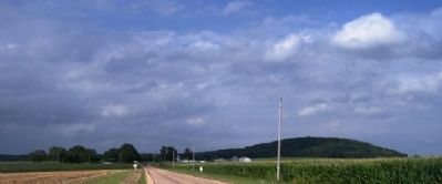
First Capitol Historic Site is located in the Driftless Area of southwestern Wisconsin. When the glaciers bypassed the area they left the soft sandstones and limestones intact to form the varied landscape you see today. Belmont Mound located directly to the east, is one reminder of the last Ice Age. This 1,400-foot mound, for which Belmont was named, was first known as "Belle Monte," which means "beautiful mountain." When the legislature met here in 1836, a sea of tall grass covered the area.
Why Meet in Belmont?
Governor Henry Dodge's selection of Belmont for the first legislative session raised speculation about his relationship with Belmont's owner, John Atchison. Dodge, however, justified his decision by citing Belmont's location in the lead mining region, the center of the territory's population.
Critics Speak Out
Residents of rival towns criticized Dodge's choice. Even before the session began, complaints rang out from across the territory regarding the poor accommodations in Belmont.
"That the legislature of the great Territory of Wisconsin should be made comfortable during the discharge of their duties, I think necessary for the enactment of good and substantial laws. Empty stomachs make clear heads but not good laws. The Lord deliver us from a set of hungry legislators."
- Dubuque Visitor, November 2, 1836
Agreeably Surprised
At least one council member, Henry Baird from Brown County, was initially impressed with Belmont.
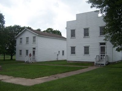
"The village of Bellemont is laid out upon a beautiful high prairie, near the foot of a mound or hill…Its situation for a prairie country is handsome...the greatest objection to it being the want of two essential requisites, wood and water. From the description which I had previously heard of it, I had made up my mind to see but two or three houses and those of inferior quality. I was therefore agreeably surprised, upon emerging from the wood to see 6 or 8 very pretty framed buildings, neatly painted, together with several other frames in a state of forwardness."
- Henry Baird, October 24, 1836
Center Map
Map of the Lead Mines on the Upper Mississippi River
Drawn and Published by R. W. Chandler, 1829.
Topics. This historical marker is listed in these topic lists: Government & Politics • Settlements & Settlers. A significant historical month for this entry is October 1421.
Location. 42° 46.089′ N, 90° 21.773′ W. Marker is in Belmont, Wisconsin, in Lafayette County. Marker is at the intersection of G and B (County Route B), on the right when traveling west
on G. Touch for map. Marker is in this post office area: Belmont WI 53510, United States of America. Touch for directions.
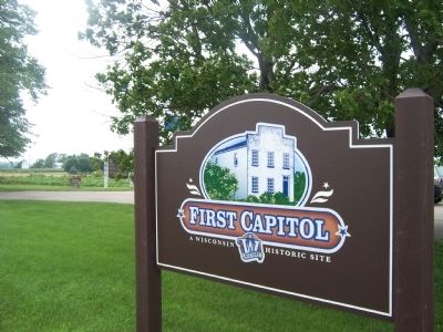
Other nearby markers. At least 8 other markers are within 7 miles of this marker, measured as the crow flies. The First Capitol (here, next to this marker); Governor Tommy G. Thompson's 1998 Address At Wisconsin's First Capitol (here, next to this marker); Belmont, Wisconsin Territory, 1836 (about 400 feet away, measured in a direct line); 1998 Wisconsin Assembly (about 400 feet away); World's Largest M (approx. 2.3 miles away); Platteville Armory (approx. 5.9 miles away); Platteville Started Here (approx. 6.1 miles away); First Congregational Church (approx. 6.3 miles away). Touch for a list and map of all markers in Belmont.
Credits. This page was last revised on February 23, 2023. It was originally submitted on July 19, 2010, by Gordon Govier of Fitchburg, Wisconsin. This page has been viewed 709 times since then and 20 times this year. Photos: 1. submitted on July 19, 2010, by Gordon Govier of Fitchburg, Wisconsin. 2. submitted on July 23, 2010, by Gordon Govier of Fitchburg, Wisconsin. 3, 4. submitted on July 19, 2010, by Gordon Govier of Fitchburg, Wisconsin. • Bill Pfingsten was the editor who published this page.


