Marshfield in Wood County, Wisconsin — The American Midwest (Great Lakes)
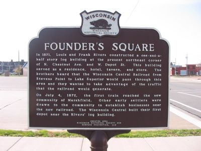
Founderís Square
On July 4, 1872, the first train reached the new community of Marshfield. Other early settlers were drawn to the community to establish businesses near the new railroad. The Wisconsin Central built their first depot near the Rivers' log building.
Erected 2002 by the Wisconsin Historical Society and Compass Properties, LLC. (Marker Number 482.)
Topics and series. This historical marker is listed in these topic lists: Railroads & Streetcars • Settlements & Settlers. In addition, it is included in the Wisconsin Historical Society series list. A significant historical month for this entry is July 1859.
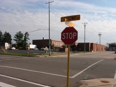
Location. 44° 40.099′ N, 90° 10.458′ W. Marker is in Marshfield, Wisconsin, in Wood County. Marker is at the intersection of North Chestnut Avenue and West Depot Street, on the right when traveling north on North Chestnut Avenue . Marker is at the northeast corner. Touch for map. Marker is in this post office area: Marshfield WI 54449, United States of America. Touch for directions.
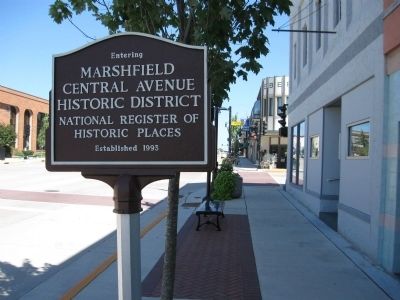
Other nearby markers. At least 8 other markers are within walking distance of this marker. Columbia Park Band Shell (about 600 feet away, measured in a direct line); Marshfield Post Office (approx. 0.2 miles away); Tower Hall (approx. 0.2 miles away); Governor William H. Upham House (approx. ľ mile away); Youth Baseball Donor Recognition Monument (approx. 0.3 miles away); Eli Winch House (approx. 0.4 miles away); September 11th Patriots Day (approx. half a mile away); Veterans Memorial (approx. half a mile away). Touch for a list and map of all markers in Marshfield.
Credits. This page was last revised on June 16, 2016. It was originally submitted on November 6, 2007, by Keith L of Wisconsin Rapids, Wisconsin. This page has been viewed 1,256 times since then and 24 times this year. Photos: 1, 2. submitted on November 6, 2007, by Keith L of Wisconsin Rapids, Wisconsin. 3. submitted on August 28, 2010, by Keith L of Wisconsin Rapids, Wisconsin. • J. J. Prats was the editor who published this page.


