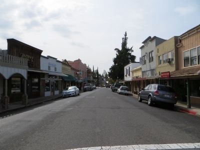
Jamestown in Tuolumne County, California — The American West (Pacific Coastal)
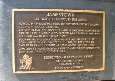
Jamestown
― Gateway to the Southern Mines ―
Arriving in 1849, Col. George F. James, a merchant popular for supplying free champagne to patrons, was elected acalde, and the town was dubbed “Jamestown.”
Poor mining investments indebted him and he quietly left town. Angry miners changed the name of the town to “American Camp.” Eventually, “Jamestown” was restored.
Jamestown’s population was approximately 4,000, before the devastating fire of October, 1885.
Erected 1991 by Matuca Chapter 1849. E Clampus Vitus.
Topics and series. This historical marker is listed in this topic list: Notable Places. In addition, it is included in the E Clampus Vitus series list. A significant historical month for this entry is October 1885.
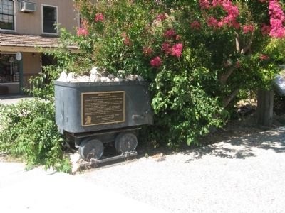
Location. 37° 57.199′ N, 120° 25.378′ W. Marker is in Jamestown, California, in Tuolumne County. Marker is at the intersection of Main Street and Seca Street, on the right when traveling south on Main Street. Marker is mounted on a mine-car at the southwest corner of Rocca Park. Touch for map. Marker is in this post office area: Jamestown CA 95327, United States of America. Touch for directions.
Other nearby markers. At least 8 other markers are within walking distance of this marker. Rocca Park (a few steps from this marker); Ramirez – Preston Building (within shouting distance of this marker); Jamestown Branch Jail (within shouting distance of this marker); National Hotel (within shouting distance of this marker); Community Hall / Jamestown Justice Court (within shouting distance of this marker); The Emporium – 1897 (within shouting distance of this marker); Jamestown United Methodist Church (about 300 feet away, measured in a direct line); Red Light District (about 300 feet away). Touch for a list and map of all markers in Jamestown.
Regarding Jamestown. This site was designated as California Registered Historical Landmark No.431 on March 16, 1949.
Colonel George James came from San Francisco and had Native Americans and other miners working for him. He lived lavishly with a well stocked tent and trading post and the town was named in his honor after he plied the locals with free champagne. He suddenly left one night leaving many unpaid and in anger they changed the name of the camp from Jamestown to American Camp. The name didn't catch on and the disrespectful name of "Jim Town" became its nickname. Then on May 25, 1851 the citizens voted and the official name of Jamestown won.
Also see . . . Jamestown, California. Western Mining History entry (Submitted on January 4, 2021, by Larry Gertner of New York, New York.)
Photographed By Syd Whittle, July 27, 2010
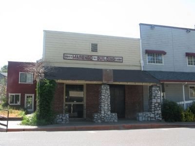
3. Marengo Building
One of many historic buildings located on Main Street. Reported to be one of the oldest early stone buildings, circa 1854. Built by Colonel William Donovan, it served as a hotel and store. In 1890 a wooden second story was added. It burned in 1926 and was restored in 1960 without its second story.
Photographed By Syd Whittle, July 27, 2010
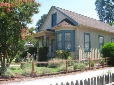
4. Fowler House
This historic Queen Anne style house, circa 1895-1897, located at 18351 Main Street is now the office of the Jamestown Sanitary District. It was built by Ambrose Morenga. The front of the house was a saloon and the rear his residence. The home was purchased in the 1900's by the McArdle family of Malones and lived in by Annetta McArdle Fowler.
Photographed By Syd Whittle, July 27, 2010
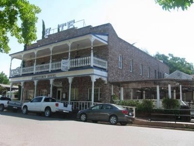
7. The Jamestown Hotel
The original hotel was built in 1919 and owned by David Martinez who expanded it several times. By 1938 the hotel was operated as the Mother Lode Hospital by Dr. D.L. Farrell. From the 1950's it was run as a rooming house. In 1978 it was renovated and reverted back to a hotel and restaurant.
Credits. This page was last revised on January 4, 2021. It was originally submitted on July 27, 2010, by Syd Whittle of Mesa, Arizona. This page has been viewed 1,428 times since then and 90 times this year. Photos: 1, 2, 3, 4, 5, 6, 7. submitted on July 27, 2010, by Syd Whittle of Mesa, Arizona. 8. submitted on October 26, 2013, by Bill Kirchner of Tucson, Arizona.
