Lower Township near Cape May in Cape May County, New Jersey — The American Northeast (Mid-Atlantic)
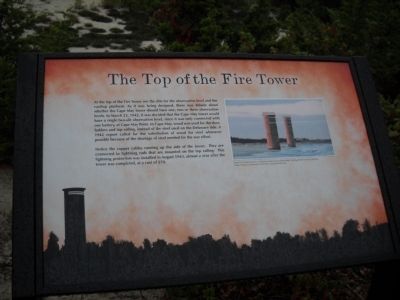
The Top of the Fire Tower
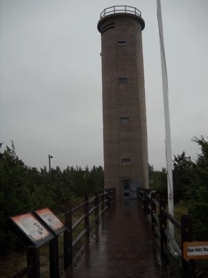
At the top of the Fire Tower are the slits for the observation level and the rooftop platform. As it was being designed, there was debate about whether the Cape May tower should have one, two or three observation levels. In March 23, 1942, it was decided that the Cape May tower would have a single two-slit observation level, since it was only connected with one battery, at Cape May Point. In Cape May, wood was used for the door, ladders and top railing, instead of the steel used on the Delaware side. A 1942 report called for the substitution of wood for steel whenever possible because of the shortage of steel needed for the war effort.
Notice the copper cables running up the side of the tower. They are connected to lightning rods that are mounted on the top railings. This lightning protection was installed in August 1943, almost a year after the tower was completed, at a cost of $70.
Topics. This historical marker is listed in this topic list: War, World II. A significant historical month for this entry is March 1942.
Location. 38° 56.612′ N, 74° 58.013′ W. Marker is near Cape May, New Jersey, in Cape May County. It is in Lower Township. Marker is on Sunset Blvd. (County Route 606), on the left when traveling west. Marker is located near the World War II Lookout Tower. Touch for map. Marker is in this post office area: Cape May NJ 08204, United States of America. Touch for directions.
Other nearby markers. At least 8 other markers are within walking distance of this marker. Construction of Fire Control Tower No. 23 (here, next to this marker); History of Coastal Defenses (here, next to this marker); Fire Control Tower No. 23 (here, next to this marker); The abrupt end of Fort Miles (here, next to this marker); Landscape (here, next to this marker); The Construction of Fort Miles (a few steps from this marker); Cape May during World War II (a few steps from this marker); All Veterans Memorial (a few steps from this marker). Touch for a list and map of all markers in Cape May.
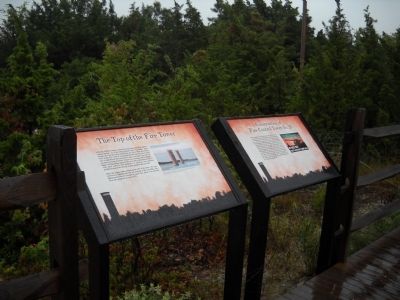
More about this marker. The background of the marker contains a silhouette of the area showing Fire Control Tower No. 23. The right of the marker features a photo of two other towers and has a caption of “These Fire Control Towers in Delaware show two and three level viewing slots for azimuth sightings. Photo Courtesy of Delaware State Parks, www.fortmiles.org”
Also see . . . Fort Miles website. (Submitted on August 27, 2010, by Bill Coughlin of Woodland Park, New Jersey.)
Credits. This page was last revised on February 7, 2023. It was originally submitted on August 27, 2010, by Bill Coughlin of Woodland Park, New Jersey. This page has been viewed 764 times since then and 10 times this year. Photos: 1, 2, 3, 4. submitted on August 27, 2010, by Bill Coughlin of Woodland Park, New Jersey.


