Marker Logo HMdb.org THE HISTORICAL
MARKER DATABASE
“Bite-Size Bits of Local, National, and Global History”
West Jordan in Salt Lake County, Utah — The American Mountains (Southwest)
 

West Jordan


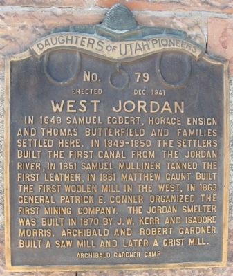
West Jordan Marker image. Click for full size.
Photographed By Jack Duffy, August 2010
1. West Jordan Marker
Inscription. In 1848, Samuel Egbert, Horace Ensign and Thomas Butterfield and families settled here. In 1849-1850 the settlers built the first canal from the Jordan River, in 1851 Samuel Mulliner tanned the first leather, in 1851 Matthew Gaunt built the first woolen mill in the west, in 1863 General Patrick E. Conner organized the first mining company. The Jordan Smelter was built in 1870 by J.W. Kerr and Isadore Morris. Archibald and Robert Gardner built a saw mill and later a grist mill.
 
Erected 1941 by Daughters of the Utah Pioneers, Archibald Gardner Camp. (Marker Number 79.)
 
Topics. This historical marker is listed in these topic lists: Industry & CommerceSettlements & Settlers. A significant historical year for this entry is 1848.
 
Location. 40° 36.484′ N, 111° 55.506′ W. Marker is in West Jordan, Utah, in Salt Lake County. Marker can be reached from the intersection of 7800 South (State Highway 48) and 1140 West. Marker is mounted on the east side of the church building located just east of the West Jordan City Cemetery. Touch for map. Marker is at or near this postal address: 1137 W 7800 South, West Jordan UT 84088, United States of America. Touch for directions.
 
Other nearby markers. At least 8 other markers are within 3 miles of this marker, measured as the crow flies. West Jordan Pioneer Church (here, next to this marker); West Jordan Industry (about 400 feet away,
Paid Advertisement
Click on the ad for more information.
Please report objectionable advertising to the Editor.
Click or scan to see
this page online
measured in a direct line); West Jordan Settlement (about 500 feet away); North Jordan Canal (about 500 feet away); Utah Idaho Sugar Factory (approx. 0.9 miles away); Salt Lake and Utah Railroad (approx. 0.9 miles away); Traders Rest (approx. 2 miles away); The Old School House (approx. 2.2 miles away). Touch for a list and map of all markers in West Jordan.
 
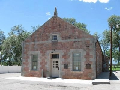
West Jordan Marker and the West Jordon Pioneer Church image. Click for full size.
Photographed By Jack Duffy, August 10, 2010
2. West Jordan Marker and the West Jordon Pioneer Church
Two markers are seen on the building. This marker is located on the far right corner of the building, and the "West Jordon Pioneer Church" marker is located to the right of the entrance door.
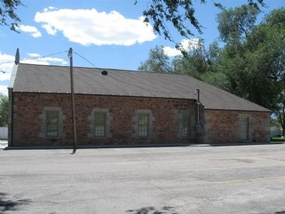
West Jordan Pioneer Church Building image. Click for full size.
Photographed By Jack Duffy, August 10, 2010
3. West Jordan Pioneer Church Building
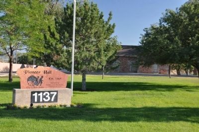
West Jordan Pioneer Church is Now Called Pioneer Hall image. Click for full size.
Photographed By Bryan R. Bauer, August 24, 2010
4. West Jordan Pioneer Church is Now Called Pioneer Hall
 
 
Credits. This page was last revised on June 16, 2016. It was originally submitted on August 16, 2010, by Jack Duffy of West Jordan, Utah. This page has been viewed 1,395 times since then and 7 times this year. Last updated on August 29, 2010, by Bryan R. Bauer of Kearns, Ut 84118. Photos:   1, 2, 3. submitted on August 16, 2010, by Jack Duffy of West Jordan, Utah.   4. submitted on August 29, 2010, by Bryan R. Bauer of Kearns, Ut 84118. • Syd Whittle was the editor who published this page.
Share this page.  
Share on Tumblr
m=35035

CeraNet Cloud Computing sponsors the Historical Marker Database.
This website earns income from purchases you make after using our links to Amazon.com. We appreciate your support.
Paid Advertisement
Apr. 26, 2024