Florence in Lauderdale County, Alabama — The American South (East South Central)
College Place Historic District
Inscription.
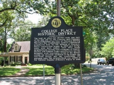
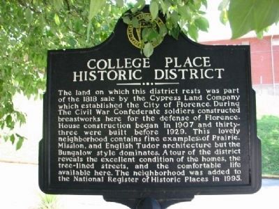
The land on which this district rests was part of the 1818 sale by the Cypress Land Company which established the City of Florence. During The Civil War Confederate soldiers constructed breastworks here for the defense of Florence. House construction began in 1907 and thirty~three were built before 1929. This lovely neighborhood contains fine examples of Prairie Mission, and English Tudor architecture but the Bungalow style dominates. A tour of the district reveals the excellent condition of the homes, the tree-lined streets and the comfortable life available here. The neighborhood was added to the National Register of Historic Places in 1995.
Erected by Florence Historical Board Florence, Alabama.
Topics. This historical marker is listed in this topic list: Notable Buildings. A significant historical year for this entry is 1818.
Location. 34° 48.773′ N, 87° 40.962′ W. Marker is in Florence, Alabama, in Lauderdale County. Marker is at the intersection of Lelia Avenue and Willingham Road on Lelia Avenue. Touch for map. Marker is at or near this postal address: 300 Lelia Avenue, Florence AL 35630, United States of America. Touch for directions.
Other nearby markers. At least 8 other markers are within walking distance of this marker. Gilbert Elementary School (approx. ¼ mile away); The University of North Alabama (approx. ¼ mile away); North Wood United Methodist Church (approx. ¼ mile away); Temple B’nai Israel (approx. 0.3 miles away); Homer Givens (approx. 0.3 miles away); Wesleyan Hall 1855 (approx. 0.3 miles away); Wesleyan Bell (approx. 0.3 miles away); Florence State Teachers College (approx. 0.3 miles away). Touch for a list and map of all markers in Florence.
Regarding College Place Historic District. Along Sherwood Ave., between W. Lelia St. and Circular Rd. Boundary increased roughly along W. Lelia and W. Mattie Lou Sts.
There are 2 markers with same information one is on 300 Lelia Avenue and Willingham Road the other is located at end of Willingham Rd and corner of Sherrod Avenue. 700 block where Willingham turns into Circle Rd.
Credits. This page was last revised on June 16, 2016. It was originally submitted on September 2, 2010, by Sandra Hughes Tidwell of Killen, Alabama, USA. This page has been viewed 1,185 times since then and 39 times this year. Photos: 1, 2. submitted on September 2, 2010, by Sandra Hughes Tidwell of Killen, Alabama, USA. • Bill Pfingsten was the editor who published this page.

