Clifton in Greenlee County, Arizona — The American Mountains (Southwest)
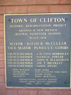
Town of Clifton
Arizona & New Mexico Railway Passenger Station
Built in 1913
Mayor - David R. McCullar
Vice-Mayor - Pamela C. Combs
Councilmember - A. M. 'Tony' Rodriquez
Councilmember - Patricia Fowler
Councilmember - John W. McLaughlin
Councilmember - Joe T. Brinkley
Councilmember - Carol Swart
Town Manager - Mark Fooks
Contractor - Town of Clifton Work Force
Grantswriter - Walter Mares
Architects - Ryden Architects
Rehabilitation Funding Sources
Phelps Dodge Mining – Morenci
CDBG - SHPO - ADOT
Topics. This historical marker is listed in this topic list: Railroads & Streetcars. A significant historical year for this entry is 1913.
Location. 33° 3.275′ N, 109° 17.891′ W. Marker is in Clifton, Arizona, in Greenlee County. Marker is on North Coronado Boulevard (U.S. 191 at milepost 163.3), on the right when traveling north. Touch for map. Marker is at or near this postal address: 100 North Coronado Boulevard, Clifton AZ 85533, United States of America. Touch for directions.
Other nearby markers. At least 8 other markers are within 15 miles of this marker, measured as the crow flies. Clifton Cliff Jail (about 500 feet away, measured in a direct line); The Eagles' Hall (approx. 0.4 miles away); Fermin Palicio Home (approx. 0.4 miles away); Phelps Dodge Hidalgo Smelter (approx. 0.4 miles away); San Francisco River (approx. 0.4 miles away); Black Hills National Back Country Byway (approx. 3.6 miles away); Jose (Joe) M. Subia Memorial Bridge (approx. 6.2 miles away); Apache Grove (approx. 14.2 miles away). Touch for a list and map of all markers in Clifton.
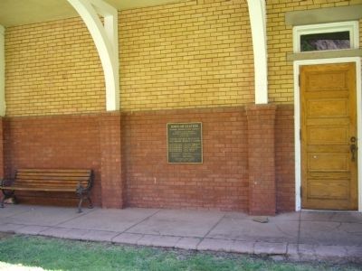
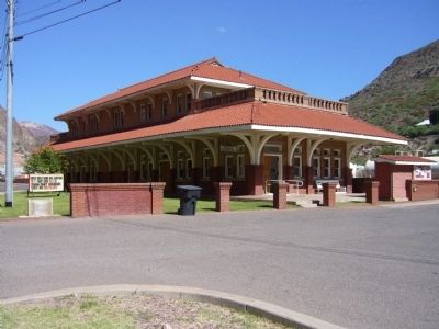
Regarding Town of Clifton. Clifton, AZ train station, built in 1913 by the Arizona & New Mexico RR that was later merged into Southern Pacific. Scheduled passenger train service was discontinued in 1967. It is now used by the Chamber of Commerce.
Credits. This page was last revised on June 16, 2016. It was originally submitted on October 7, 2010, by Bill Kirchner of Tucson, Arizona. This page has been viewed 1,156 times since then and 35 times this year. Photos: 1, 2, 3. submitted on October 7, 2010, by Bill Kirchner of Tucson, Arizona. • Syd Whittle was the editor who published this page.


