Roseville in Placer County, California — The American West (Pacific Coastal)
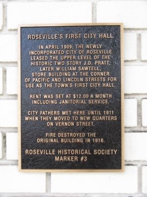
Roseville’s First City Hall
Rent was set at $12.00 per month including janitorial services.
City fathers met here until 1911 when they moved to new quarters on Vernon Street.
Fire destroyed the original building in 1916.
Erected by Roseville Historical Society. (Marker Number 3.)
Topics. This historical marker is listed in this topic list: Government & Politics. A significant historical month for this entry is April 1909.
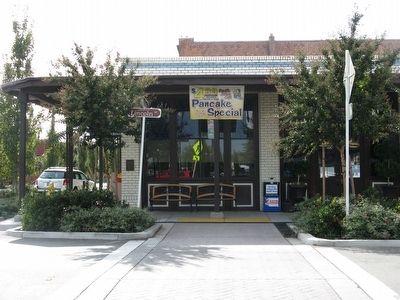
Location. 38° 45.062′ N, 121° 17.067′ W. Marker is in Roseville, California, in Placer County. Marker is at the intersection of Lincoln Street and Pacific Street, on the right when traveling south on Lincoln Street. Marker is mounted on the left corner of the restaurant building that now occupies this site. Touch for map. Marker is in this post office area: Roseville CA 95678, United States of America. Touch for directions.
Other nearby markers. At least 8 other markers are within walking distance of this marker. Barker Hotel (within shouting distance of this marker); Bank of Italy Building (about 300 feet away, measured in a direct line); The Owl Club Building (about 300 feet away); Roseville Tribune and Register Building (about 300 feet away); Chicago West Building (about 400 feet away); McRae Building (about 400 feet away); Roseville's First Hospital (about 400 feet away); Roseville (about 500 feet away). Touch for a list and map of all markers in Roseville.
Credits. This page was last revised on June 16, 2016. It was originally submitted on October 22, 2010, by Syd Whittle of Mesa, Arizona. This page has been viewed 840 times since then and 26 times this year. Photos: 1, 2. submitted on October 22, 2010, by Syd Whittle of Mesa, Arizona.

