Near Bentonville in Page County, Virginia — The American South (Mid-Atlantic)
Overall Bridge
Design Innovation
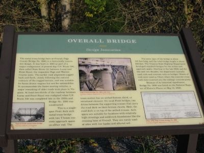
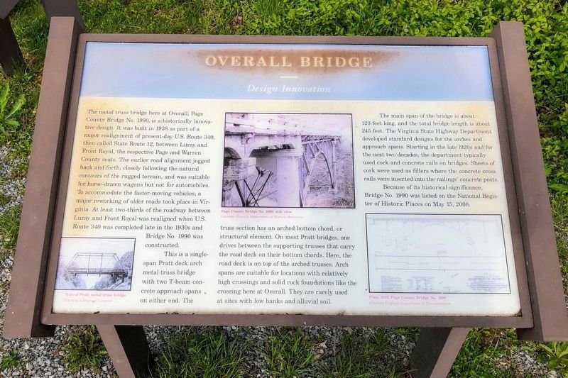
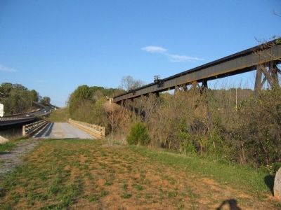
The metal truss bridge here at Overall, Page County Bridge No. 1990, is a historically innovative design. It was built in 1938 as part of a major realignment of present-day U.S. Route 340, then called State Route 12, between Luray and Front Royal, the respective Page and Warren County seats. The earlier road alignment jogged back and forth, closely following the natural contours of the rugged terrain, and was suitable for horse-drawn wagons but not for automobiles. To accommodate the faster-moving vehicles, a major reworking of older roads took place in Virginia. At least two-thirds of the roadway between Luray and Front Royal was realigned when U.S. Route 340 was completed late in the 1930s and Bridge No. 1990 was constructed.
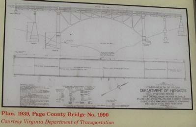
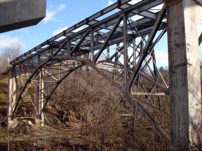
This single-span Pratt deck arch metal truss bridge with two T-beam concrete approach spans on either end. The truss section has an arched bottom chord, or structural element. On most Pratt bridges, one drives between the supporting trusses that carry the road deck on their bottom chords. Here, the road deck is on top of the arched trusses. Arch spans are suitable for locations with relatively high crossings and solid rock foundations like the crossing here at Overall. They are rarely used at sites with low banks and alluvial soil.
The main span of the bridge is about 123 feet long, and the total bridge length is about 245 feet. The Virginia State Highway Department developed standard designs for the arches and approach spans. Starting in the late 1920s and for the next two decades, the department typically used cork and concrete rails on bridges. Sheets of cork were used as fillers where the concrete cross rails were inserted into the railings' concrete posts.
Because of its historical significance, Bridge No. 1990 was listed on the National Register of Historic Places on May 15, 2008.
Topics. This historical marker is listed in this topic list: Bridges & Viaducts. A significant historical month for this entry is May 1740.
Location. 38° 48.339′ N, 78° 20.948′ W. Marker is near Bentonville, Virginia, in Page County. Marker is at the intersection of Stonewall Jackson Highway (U.S. 340) and Overall Road, on the right when traveling north on Stonewall Jackson Highway. Touch for map. Marker is at or near this postal address: 11785 U S Hwy 340n, Bentonville VA 22610, United States of America. Touch for directions.
Other nearby markers. At least 8 other markers are within 5 miles of this marker, measured as the crow flies. The Historic Page Valley (here, next to this marker); Battle of Milford (here, next to this marker); U.S. Route 340 (here, next to this marker); Warren County / Page County (about 400 feet away, measured in a direct line); Everett Cullers Overlook (approx. 4 miles away); Fort Valley Church of God in Christ Jesus
(approx. 4.7 miles away); Help Wanted! (approx. 4.8 miles away); Civilian Conservation Corps (approx. 4.8 miles away). Touch for a list and map of all markers in Bentonville.
Also see . . . Page County Bridge No. 1990. Virginia Department of Historic Resources website entry (Submitted on October 25, 2010, by Craig Swain of Leesburg, Virginia.)
Credits. This page was last revised on August 18, 2022. It was originally submitted on October 25, 2010, by Craig Swain of Leesburg, Virginia. This page has been viewed 895 times since then and 31 times this year. Photos: 1. submitted on October 25, 2010, by Craig Swain of Leesburg, Virginia. 2. submitted on May 18, 2021, by Shane Oliver of Richmond, Virginia. 3, 4, 5. submitted on October 25, 2010, by Craig Swain of Leesburg, Virginia. 6. submitted on January 14, 2012.
