Madison in Dane County, Wisconsin — The American Midwest (Great Lakes)
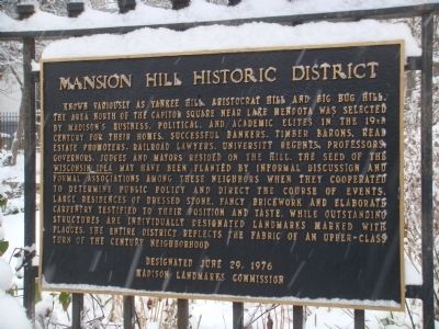
Mansion Hill Historic District
Erected 1976 by the Madison Landmarks Commission.
Topics. This historical marker is listed in this topic list: Notable Places.
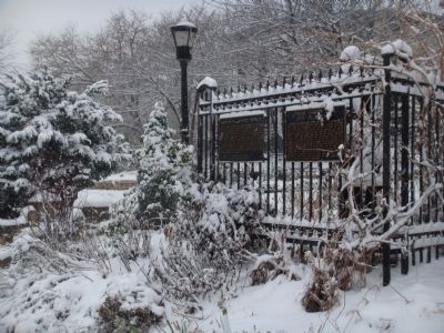
Location. 43° 4.725′ N, 89° 23.185′ W. Marker is in Madison, Wisconsin, in Dane County. Marker is at the intersection of East Gorham Street and North Pinckney Street on East Gorham Street. Marker is mounted on the fence at Period Garden Park. Touch for map. Marker is at or near this postal address: 102 East Gorham Street, Madison WI 53703, United States of America. Touch for directions.
Other nearby markers. At least 8 other markers are within walking distance of this marker. Period Garden Park (here, next to this marker); Timothy Brown House (a few steps from this marker); Keyes House (within shouting distance of this marker); Bashford House (within shouting distance of this marker); Pierce House (about 300 feet away, measured in a direct line); Kendall House (about 300 feet away); Old Governor's Mansion (about 400 feet away); Keenan House (about 400 feet away). Touch for a list and map of all markers in Madison.
Regarding Mansion Hill Historic District. Mansion Hill is the residential neighborhood north of the Square in downtown Madison. Its heart is the corner of Gilman and Pinckney Streets, where four Victorian mansions evoke an aura of yesteryear. In the 19th century, Mansion Hill was one of Madison's two most prestigious neighborhoods (the other, along East and West Wilson Street, has been mostly obliterated by time). Mansion Hill contains the greatest concentration of intact Victorian houses remaining in Madison, many of which were the homes of Madison's pioneer movers-and-shakers.
In the 1950s, '60s and '70s several of the finest old houses in Mansion Hill were demolished to make way for anonymous apartment buildings and two large insurance companies. Fearful of further erosion of the residential character of this historic neighborhood, residents petitioned the City to designate Mansion Hill as an historic district. The
Common Council complied and Mansion Hill became Madison's first historic district in 1976.
From the Historic Preservation Website http://www.cityofmadison.com/planning/landmark/LndmrkHist.html
Related markers. Click here for a list of markers that are related to this marker. This is a list of markers for buildings in the Mansion Hill Historic District.
Credits. This page was last revised on August 6, 2021. It was originally submitted on December 4, 2010, by William J. Toman of Green Lake, Wisconsin. This page has been viewed 1,865 times since then and 123 times this year. Photos: 1, 2. submitted on December 4, 2010, by William J. Toman of Green Lake, Wisconsin. • Syd Whittle was the editor who published this page.

