Goodsprings in Clark County, Nevada — The American Mountains (Southwest)
Good's Spring
Inscription.
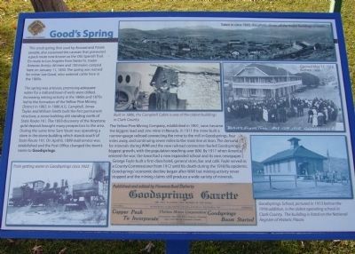
This small spring, first used by Anasazi and Paiute people, also sustained the caravan that pioneered a pack route now known as the Old Spanish Trail. En route to Los Angeles from Santa Fe, trader Antonio Armijo, 60 men and 100 mules camped here on January 11, 1830. The spring was named for miner Joe Good, who watered cattle here in the 1860's.
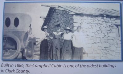
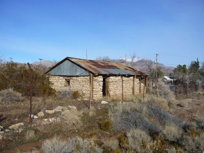
The spring was artesian, promising adequate water for a mill and town if wells were drilled. Increasing mining activity in the 1860's and 1870's led to the formation of the Yellow Pine Mining District in 1882. In 1886 A.G. Campbell, Jonas Taylor and William Smith built the first permanent structure, a stone building still standing north of State Route 161. The 1893 discovery of the Keystone gold deposit brought many prospectors to the area. During the same time Sam Yount was operating a store in the stone building which stands south of State Route 161. On April 6, 1899 mail service was established and the Post Office changed the town's name to Goodsprings.
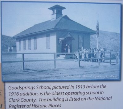
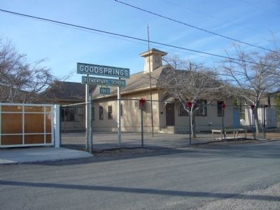
The Yellow Pine Mining Company, established in 1901, soon became the biggest lead and zinc mine in Nevada. In 1911 the mine built a narrow-gauge railroad connecting the mine to the mill in Goodsprings, four miles away, and continuing seven miles to the main line at Jean. The demand for minerals during WWI and the new railroad connection fueled Goodsprings' biggest growth, with the population reaching over 800. By 1917 when America entered the war, the town had a new expanded school and its own newspaper. George Fayle built a first-class hotel, general store, bar and café'. Fayle served as a County Commissioner from 1912 until his death during the 1918 flu epidemic. Goodsprings' economic decline began after WWI but mining activity never stopped and the mining claims still produce a wide variety of minerals.
Erected by Clark County.
Topics and series. This historical marker is listed in these topic lists: Natural Resources • Settlements & Settlers. In addition, it is included in the Old Spanish National Trail series list. A significant historical month for this entry is January 1809.
Location. 35° 49.892′ N, 115° 26.115′ W. Marker is in Goodsprings, Nevada, in Clark County. Marker is on San Pedro Street, on the right when traveling east. Marker is located at Goodsprings Park. Touch for map. Marker is at or near this postal address: 365 San Pedro Street, Jean NV 89019, United States of America. Touch for directions.
Other nearby markers. At least 8 other markers are within 10 miles of this marker, measured as the crow flies. Goodsprings Mining District 1856 - 1957 (about 400 feet away, measured in a direct line); The Pioneer Saloon (approx. 0.2 miles away); Jean, Nevada (approx. 7.2 miles away); The Arrowhead Trail Highway (approx. 7.2 miles away); The Yellow Pine Mining Company Railroad (approx. 7.2 miles away); The Last Spike (approx. 8.3 miles away); a different marker also named The Last Spike (approx. 9.1 miles away); Sandy Valley (approx. 9.7 miles away). Touch for a list and map of all markers in Goodsprings.
Credits. This page was last revised on June 16, 2016. It was originally submitted on January 5, 2011, by Bill Kirchner of Tucson, Arizona. This page has been viewed 1,296 times since then and 48 times this year. Photos: 1, 2, 3, 4, 5, 6. submitted on January 5, 2011, by Bill Kirchner of Tucson, Arizona. • Syd Whittle was the editor who published this page.
