Monongahela in Washington County, Pennsylvania — The American Northeast (Mid-Atlantic)
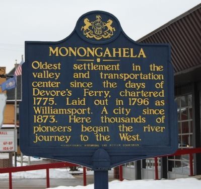
Monongahela
Oldest settlement in the valley and transportation center since the days of Devore's Ferry, chartered 1775. Laid out in 1796 as Williamsport. A city since 1873. Here thousands of pioneers began the river journey to the West.
Erected 1947 by Pennsylvania Historical and Museum Commission.
Topics and series. This historical marker is listed in these topic lists: Industry & Commerce • Settlements & Settlers. In addition, it is included in the Pennsylvania Historical and Museum Commission series list. A significant historical year for this entry is 1775.
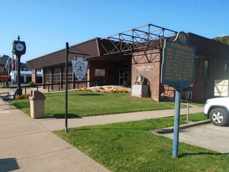
Location. 40° 12.234′ N, 79° 55.658′ W. Marker is in Monongahela, Pennsylvania, in Washington County. Marker is at the intersection of Main Street (Pennsylvania Route 88/136) and 5th Street, on the right when traveling west on Main Street. Marker is located in front of the Monongahela Municipal Building. Touch for map. Marker is at or near this postal address: 449 West Main Street, Monongahela PA 15063, United States of America. Touch for directions.
Other nearby markers. At least 8 other markers are within walking distance of this marker. Joseph Parkison (a few steps from this marker); U.S.S. Monongahela Anchor (within shouting distance of this marker); First Methodist Church (within shouting distance of this marker); Bell (about 600 feet away, measured in a direct line); The Hiker (about 600 feet away); U.S.S. Maine (about 600 feet away); Baptist Church Bell (about 700 feet away); World War Roll of Honor (approx. 0.2 miles away). Touch for a list and map of all markers in Monongahela.
Also see . . .
1. History of the City of Monongahela. Official Site of the City of Monongahela, Pennsylvania. (Submitted on January 30, 2011, by Bernard Fisher of Richmond, Virginia.)
2. Monongahela, Pennsylvania. Wikipedia entry (Submitted on July 21, 2022, by Larry Gertner of New York, New York.)
Credits. This page was last revised on October 17, 2023. It was originally submitted on January 29, 2011, by Mike Wintermantel of Pittsburgh, Pennsylvania. This page has been viewed 623 times since then and 16 times this year. Photos: 1. submitted on January 29, 2011, by Mike Wintermantel of Pittsburgh, Pennsylvania. 2. submitted on October 17, 2023, by William Fischer, Jr. of Scranton, Pennsylvania. • Bernard Fisher was the editor who published this page.

