Fairywood in Pittsburgh in Allegheny County, Pennsylvania — The American Northeast (Mid-Atlantic)
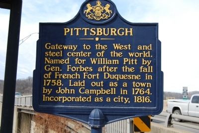
Pittsburgh
Erected 1946 by Pennsylvania Historical and Museum Commission.
Topics and series. This historical marker is listed in these topic lists: Forts and Castles • Political Subdivisions • Settlements & Settlers. In addition, it is included in the Pennsylvania Historical and Museum Commission series list. A significant historical year for this entry is 1758.
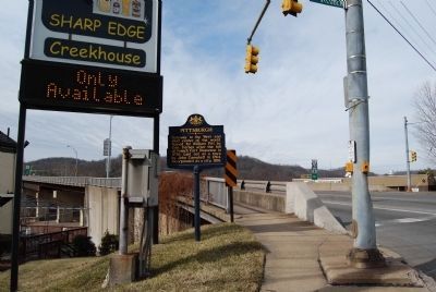
Location. 40° 26.423′ N, 80° 4.837′ W. Marker is in Pittsburgh, Pennsylvania, in Allegheny County. It is in Fairywood. Marker is at the intersection of West Steuben Street (Pennsylvania Route 60) and Woodmere Drive, on the right when traveling east on West Steuben Street. Located on grounds of Sharp Edge Creekhouse. Touch for map. Marker is at or near this postal address: 288 W Steuben St, Pittsburgh PA 15205, United States of America. Touch for directions.
Other nearby markers. At least 8 other markers are within 3 miles of this marker, measured as the crow flies. Hand's Hospital (approx. 0.4 miles away); Borough of Pennsbury Village (approx. 1.3 miles away); Richard L. "Dick" Thornburgh (approx. 1.3 miles away); Saint Mary's Parish World War II Memorial (approx. 1.8 miles away); Saint Mary's World War II Honor Roll (approx. 1.8 miles away); The McKee Mansion (approx. 2.3 miles away); Corliss Street Tunnel (approx. 2.3 miles away); Honus Wagner (approx. 2.3 miles away).
Also see . . .
1. Pittsburgh - Behind the Marker. (Submitted on July 7, 2011, by Mike Wintermantel of Pittsburgh, Pennsylvania.)
2. City of Pittsburgh. Official Website (Submitted on July 26, 2011, by Mike Wintermantel of Pittsburgh, Pennsylvania.)
Credits. This page was last revised on February 2, 2023. It was originally submitted on February 20, 2011, by Mike Wintermantel of Pittsburgh, Pennsylvania. This page has been viewed 748 times since then and 30 times this year. Photos: 1, 2. submitted on February 20, 2011, by Mike Wintermantel of Pittsburgh, Pennsylvania. • Bill Pfingsten was the editor who published this page.

