Vandergrift in Westmoreland County, Pennsylvania — The American Northeast (Mid-Atlantic)
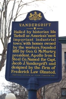
Vandergrift
Erected 1990 by Pennsylvania Historical and Museum Commission.
Topics and series. This historical marker is listed in these topic lists: Industry & Commerce • Settlements & Settlers. In addition, it is included in the Pennsylvania Historical and Museum Commission series list. A significant historical year for this entry is 1895.
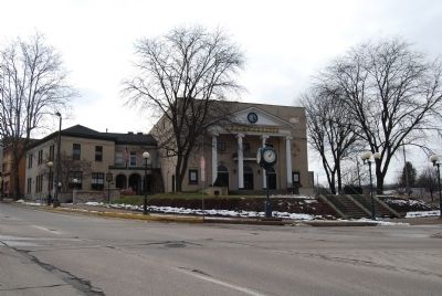
Location. 40° 36.244′ N, 79° 33.889′ W. Marker is in Vandergrift, Pennsylvania, in Westmoreland County. Marker is on Washington Avenue (Pennsylvania Route 56). Located on the grounds of the Casino Theater. Touch for map. Marker is in this post office area: Vandergrift PA 15690, United States of America. Touch for directions.
Other nearby markers. At least 8 other markers are within 7 miles of this marker, measured as the crow flies. A different marker also named Vandergrift (within shouting distance of this marker); St Gertrude Roman Catholic Church (approx. 0.3 miles away); Nellie Bly (approx. 1.3 miles away); Pennsylvania Canal (approx. 2.4 miles away); D. Leech & Company / Western Transportation Company (approx. 2.7 miles away); The Siberian Iron Works (approx. 2.8 miles away); Fort Hand (approx. 4˝ miles away); In Memory of Lieutenant Michael Schall, Sr. (approx. 7.1 miles away). Touch for a list and map of all markers in Vandergrift.
Credits. This page was last revised on June 16, 2016. It was originally submitted on February 27, 2011, by Mike Wintermantel of Pittsburgh, Pennsylvania. This page has been viewed 522 times since then and 18 times this year. Photos: 1, 2. submitted on February 27, 2011, by Mike Wintermantel of Pittsburgh, Pennsylvania. • Bill Pfingsten was the editor who published this page.

