Alexandria in Fairfax County, Virginia — The American South (Mid-Atlantic)
In Support of American Defense
George Washington Memorial Parkway
— National Park Service, U.S. Department of the Interior —
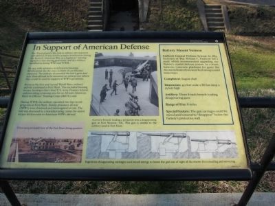
Fort Hunt played a key role in military development and defense. It was used as a major fortification during the Spanish-American War, as a logistical/training support center during peacetime, and as a military installation during WWI and WWII.
By 1917, with advances in military technology, fortifications like the ones in front of you became outdated. The military dismantled the fort's guns and sent them abroad to be mounted on railway cars where they could be used in support of WWI operations.
Between the first and second World Wars, military activity continued at Fort Hunt. This included housing troops, hosting a short-lived U.S. Army Finance School, and providing a training area for an African-American Reserve Officers' Training Corps (ROTC) unit.
During WWII, the military operated two top-secret programs at Fort Hunt. Enemy prisoners-of-war (POWs) were detained and interrogated on site. The fort was also used as a manufacturing center for secret escape devices sent to American POWs abroad.
Battery Mount Vernon
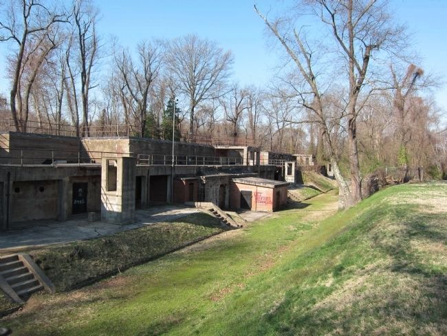
Endicott Coastal Defense System: In 1885, Secretary of War William C. Endicott led a study which recommended upgrading our Nation's coastal defense system. As a result, batteries (concrete platforms for guns) like the one in front of you were built along coastal waterways.
Completed: August 1898
Dimension: 417 feet wide x 88 feet deep x 23 feet high
Artillery: Three 8-inch breech-loading disappearing guns
Range of Fire: 8 miles
Special Features: The gun carriages could be raised and lowered to "disappear" below the battery's protective wall.
Erected by National Park Service, U.S. Department of the Interior.
Topics. This historical marker is listed in these topic lists: African Americans • Military • War, Spanish-American • War, World I • War, World II. A significant historical year for this entry is 1917.
Location. 38° 42.912′ N, 77° 3.087′ W. Marker is in Alexandria, Virginia, in Fairfax County. Marker is on Fort Hunt Park Loop, on the left when traveling west. Located in Fort Hunt Park, a unit of the George Washington Memorial Parkway administered by the National Park Service. Touch for map. Marker is in this post office area: Alexandria VA 22308, United States of America. Touch for directions.
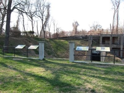
Other nearby markers. At least 8 other markers are within walking distance of this marker. Civilian Conservation Corps (here, next to this marker); People and the Land (here, next to this marker); Fort Hunt Park (here, next to this marker); Battery Mount Vernon (here, next to this marker); Beyond What You See Today (within shouting distance of this marker); P.O. Box 1142 (within shouting distance of this marker); WW II: A Battle Fought at Home and Abroad (about 400 feet away, measured in a direct line); Battery Sater (approx. 0.2 miles away). Touch for a list and map of all markers in Alexandria.
More about this marker. A photo on the lower left is a Circa 1909 postcard view of the Fort Hunt living quarters.
Credits. This page was last revised on August 7, 2022. It was originally submitted on March 27, 2011, by Craig Swain of Leesburg, Virginia. This page has been viewed 660 times since then and 14 times this year. Photos: 1. submitted on March 27, 2011, by Craig Swain of Leesburg, Virginia. 2, 3. submitted on June 5, 2011, by Craig Swain of Leesburg, Virginia.


