Alexandria in Fairfax County, Virginia — The American South (Mid-Atlantic)
Fort Hunt Park
George Washington Memorial Parkway
— National Park Service, U.S. Department of the Interior —
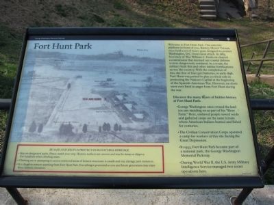
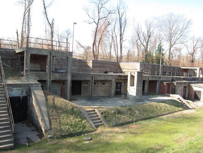
Welcome to Fort Hunt Park. The concrete platform in front of you, Battery Mount Vernon, once held a set of heavy guns designed to protect Washington, D.C. from naval attack. In 1885, Secretary of War William C. Endicott chaired a commission that deemed our coastal defense system dangerously outdated. As a result, the military built this and other similar fortifications across the country. With the completion of this, the first of four gun batteries, in early 1898, Fort Hunt was poised to play a critical role in protecting the Nation's Capital at the beginning of the Spanish-American War. However no shots were ever fired in anger from Fort Hunt during the war.
Discover the many layers of hidden history at Fort Hunt Park:
• George Washington once owned the land you are standing on as part of his "River Farm." Here, enslaved people sowed seeds and gathered crops on the same terrain where American Indians hunted and fished for centuries.
• The Civilian Conservation Corps operated a camp for workers at this site during the Great Depression.
• In 1933, Fort Hunt Park became part of a national park, the George Washington Memorial Parkway.
• During World War II, the U.S. Army Military Intelligence Service managed two secret operations here.
Erected by National Park Service, U.S. Department of the Interior.
Topics and series. This historical marker is listed in these topic lists: Charity & Public Work • War, Spanish-American • War, World II. In addition, it is included in the Civilian Conservation Corps (CCC) series list. A significant historical year for this entry is 1885.
Location. 38° 42.912′ N, 77° 3.081′ W. Marker is in Alexandria, Virginia, in Fairfax County. Marker is on Fort Hunt Park Loop, on the left when traveling east. Located in Fort Hunt Park, a unit of the George Washington Memorial Parkway administered by the National Park Service. Touch for map. Marker is in this post office area: Alexandria VA 22308, United States of America. Touch for directions.
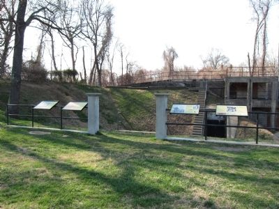
Other nearby markers. At least 8 other markers are within walking distance of this marker. Battery Mount Vernon (here, next to this marker); People and the Land (here, next to this marker); Civilian Conservation Corps (here, next to this marker); In Support of American Defense (here, next to this marker); Beyond What You See Today (within shouting distance of this marker); P.O. Box 1142 (within shouting distance of this marker); WW II: A Battle Fought at Home and Abroad (about 400 feet away, measured in a direct line); Battery Sater (approx. 0.2 miles away). Touch for a list and map of all markers in Alexandria.
More about this marker.
[Safety information on the marker:]
Be safe and help us protect our cultural heritage
• Stay on designated paths. Please watch your step. Historic surfaces are uneven and may be damp or slippery. Use handrails when climbing stairs.
• Climbing on or attempting to access restricted areas of historic structures is unsafe and may damage park resources.
• It is illegal to remove anything from Fort Hunt Park. Everything is protected so you and future generations may enjoy these historic resources.
Credits. This page was last revised on August 6, 2022. It was originally submitted on March 27, 2011, by Craig Swain of Leesburg, Virginia. This page has been viewed 1,166 times since then and 44 times this year. Photos: 1. submitted on March 27, 2011, by Craig Swain of Leesburg, Virginia. 2, 3. submitted on June 5, 2011, by Craig Swain of Leesburg, Virginia.


