Near Dublin in Pulaski County, Virginia — The American South (Mid-Atlantic)
"Dunkard's Bottom"
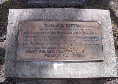
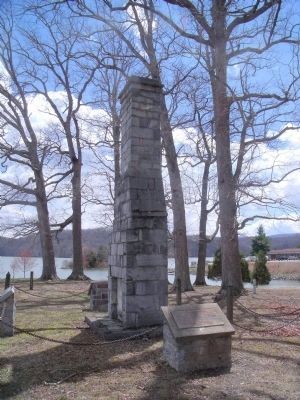
This tablet commemorates the first white settlement west of New River, made in 1745 near here by "Dunkers". In 1756 they built a fort for protection against Indians. In 1771 Col. William Christian built a home on this site. The stones in this monument are from the chimneys of that home. This marker erected 1937 by Count Pulaski Chapter D.A.R. Pulaski, VA.
Erected 1937 by Count Pulaski Chapter D.A.R. Pulaski, VA.
Topics and series. This historical marker is listed in these topic lists: Forts and Castles • Settlements & Settlers. In addition, it is included in the Daughters of the American Revolution series list. A significant historical year for this entry is 1745.
Location. Marker has been reported missing. It was located near 37° 3.429′ N, 80° 37.259′ W. Marker was near Dublin, Virginia, in Pulaski County. Marker could be reached from Ben H Bolen Drive, 0.1 miles east of State Park Road (Virginia Route 660). This marker is located in Claytor Lake State Park. Touch for map. Marker was at or near this postal address: 6620 Ben H Bolen Drive, Dublin VA 24084, United States of America. Touch for directions.
Other nearby markers. At least 8 other markers are within 5 miles of this location, measured as the crow flies. Christian-Cloyd Chimney (a few steps from this marker); Colonel William Christian (a few steps from this marker); Snowville Christian Church (approx. 3.7 miles away); High Water Mark (approx. 3.8 miles away); Water Works — 1870 (approx. 4 miles away); First Court House (approx. 4 miles away); The First Court held in Pulaski County (approx. 4 miles away); Newbern Christian Church (approx. 4.2 miles away). Touch for a list and map of all markers in Dublin.
Regarding "Dunkard's Bottom". "...Thomas Cloyd settled Dunkard’s Bottom, an area of about 7000 acres along the New River, well south of
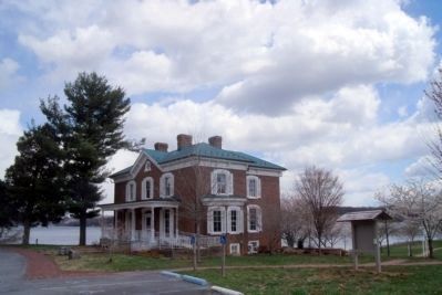
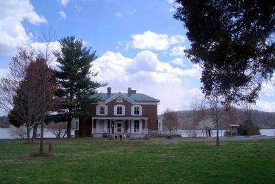
Cloyd’s Mountain. The name Dunkard’s Bottom derived from earlier settlement of Dunkers, a German religious sect. Dunkers settled in several regions of southwestern Virginia during the eighteenth century. According to family history, Thomas Cloyd lived in one of the earlier German settlement houses until his large 2-story, 3-bay brick Greek Revival house was finished in the 1847, appropriately named “Dunkard’s Bottom”. When Haven Boyd Howe and Catherine McGavock Cloyd were married in 1873, she received a dower interest from David Cloyd’s estate (her grandfather). The area that became Howe’s Crescent Falls Stock Farm comprised of approximately 2000 acres of the significant Cloyd holdings. The land included mountain and river bottomland at the New River. A great portion of the property, including the Dunkard’s Bottom and house site of the same name, are under the present day Claytor Lake. A chimney that has been reconstructed near the Haven Boyd Howe House is thought to be from the Christian family house, one of the early homesteads that comprised the German settlement. The chimney was moved from Claytor Lake and reconstructed in 1989." National Register of Historic Places, Havcn B. Howe House. VDHR # 077-0047
Also see . . .
1. Claytor Lake State Park. Virginia Department of Conservation and Recreation (Submitted on April 5, 2011.)
2. Haven B. Howe House. National Register of Historic Places (Submitted on April 5, 2011.)
Credits. This page was last revised on November 11, 2021. It was originally submitted on April 5, 2011, by Bernard Fisher of Richmond, Virginia. This page has been viewed 2,786 times since then and 107 times this year. Photos: 1, 2, 3, 4. submitted on April 5, 2011, by Bernard Fisher of Richmond, Virginia.


