Knights Ferry in Stanislaus County, California — The American West (Pacific Coastal)
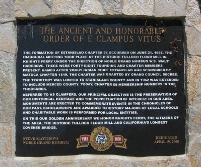
The Ancient and Honorable Order of E Clampus Vitus
Inscription.
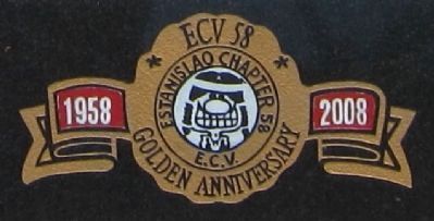
The establishment of Estanislao Chapter 58 occurred on June 21, 1958. The inaugural meeting took place at the historic Tulloch Flour Mill in Knights Ferry under the direction of Noble Grand Humbug W.S. 'Walt' Hargrove. There were forty-eight founding and charter members present. Named after Yokut Chief Estanislao and sponsored by Matuca Chapter 1849, the charter was granted by Grand Council Decree. The territory was limited to Stanislaus County and in 1962 was extended to include Merced County. Today, Chapter 58 membership numbers in the thousands.
Referred to as Clampers, our principal objective is the preservation of our historical heritage and perpetuation of interest in our area. Monuments are erected to commemorate events in the chronicles of our past. Scholarships are awarded to history majors of local schools and charitable work is performed for local entities.
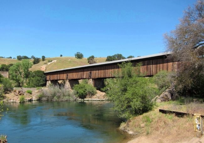
On this our golden anniversary we honor Knights Ferry, the citizens of the area, the Historic Tulloch Flour Mill, and California's longest covered bridge.
Steve Matthews, Noble Grand Humbug • Dedicated April 19, 2008
Erected 2008 by E Clampus Vitus, Estanislao Chapter No. 58.
Topics and series. This historical marker is listed in this topic list: Fraternal or Sororal Organizations . In addition, it is included in the E Clampus Vitus series list. A significant historical date for this entry is April 19, 1797.
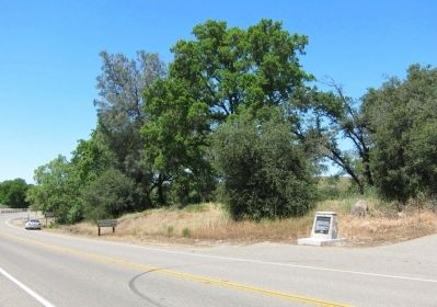
Location. 37° 48.98′ N, 120° 39.887′ W. Marker is in Knights Ferry, California, in Stanislaus County. Marker is on Sonora Road, 0.2 miles north of Kennedy Road, on the right when traveling north. Touch for map. Marker is in this post office area: Oakdale CA 95361, United States of America. Touch for directions.
Other nearby markers. At least 8 other markers are within walking distance of this marker. Buena Vista (approx. ¼ mile away); Power Generation (approx. ¼ mile away); Tulloch’s Mill (approx. ¼ mile away); Knight's Ferry Bridge (approx. ¼ mile away); Mill House (approx. 0.3 miles away); Knights Ferry Covered Bridge (approx. 0.3 miles away); Knights Ferry No. 2 (approx. 0.4 miles away); Knights Ferry - The Store (approx. 0.4 miles away). Touch for a list and map of all markers in Knights Ferry.
Also see . . . Estanislao Chapter 58 (unofficial) Page. Has links to an explanation of their Chief Estanislao logo, Clamper History, a selection of their historical markers, and a tribute to Vietnam veterans. (Submitted on May 3, 2011.)
Photographed By Andrew Ruppenstein, April 30, 2011
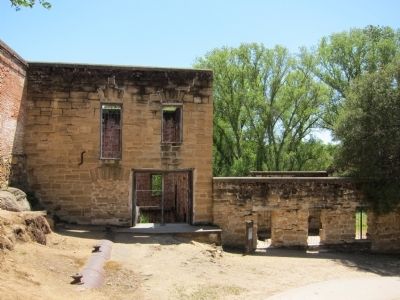
4. The remains of Tulloch's Mill
A grist mill stood here as early as the 1850's. A replacement was erected in its place after the flood of 1862, and sometime before 1900 the mill was converted to a hydroelectic plant, which supplied electricity to the area into the late 1920's. It was here that the Estanislao Chapter first met in 1958.
Photographed By Andrew Ruppenstein, April 30, 2011
5. Knight's Ferry Covered Bridge, spanning the Stanislaus River (mentioned on marker)
The Knight's Ferry Bridge was built in 1863-64 to replace an 1857 uncovered wooden truss that was destroyed in a flood. This was an important crossing on the heavily traveled Stockton-Sonora Road during the California Gold Rush. The Knight's Ferry Bridge is the longest covered bridge west of the Mississippi River. - Historic American Buildings Survey statement of significance
Credits. This page was last revised on July 26, 2021. It was originally submitted on May 3, 2011, by Andrew Ruppenstein of Lamorinda, California. This page has been viewed 1,496 times since then and 37 times this year. Last updated on July 26, 2021, by Ronald D. (Ron) Trigueiro of Fresno, California. Photos: 1, 2, 3, 4, 5. submitted on May 3, 2011, by Andrew Ruppenstein of Lamorinda, California. • J. Makali Bruton was the editor who published this page.
