Winona in Winona County, Minnesota — The American Midwest (Upper Plains)
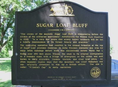
Sugar Loaf Bluff
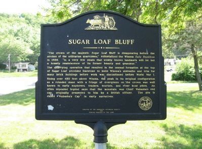
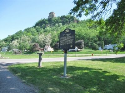
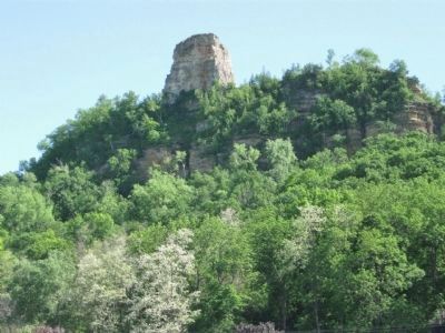
The quarrying operation that resulted in the unusual formation at the top of Sugar Loaf provided limestone to build Winona's sidewalks and trim for many brick buildings before work was discontinued before World War I.
Rising over 450 feet above Winona, the peak in its original configuration as a rounded dome with a fringe of evergreen on the crown was well known to early explorers, traders, tourists, and river boat pilots. An often repeated legend says that the mountain was Chief Wabasha's red cap, originally presented to him by a British officer. The site is called "Wabasha's Cap" in early narratives.
Erected by the Minnesota Historical Society
1989
Funding provided by the LCMR
Erected 1989 by the Minnesota Historical Society, funding by the LCMR [Legislative Commission on Minnesota Resources].
Topics and series. This historical marker is listed in this topic list: Landmarks. In addition, it is included in the Daughters of the American Revolution, and the Minnesota Historical Society series lists. A significant historical year for this entry is 1886.
Location. 44° 1.913′ N, 91° 37.672′ W. Marker is in Winona, Minnesota, in Winona County. Marker is on Parks Avenue north of U.S. 14 / 61, on the left when traveling north. Marker is next to a small parking area near the southeast shore of Lake Winona. Touch for map. Marker is in this post office area: Winona MN 55987, United States of America. Touch for directions.
Other nearby markers. At least 8 other markers are within 2 miles of this marker, measured as the crow flies. U.S. Coast Guard Cutter Winona (approx. 0.9 miles away); The Watkins Manor House (approx. 1.1 miles away); Garvin Heights (approx. 1.2 miles away); Winona: River Village, Lumber Town, College Town (approx. 1.2 miles away); J. R. Watkins Medical Company (approx. 1.2 miles away); Winona County Soldiers and Sailors Memorial (approx. 1.4 miles away); Stephen Taylor (approx. 1˝ miles away); Winona County Courthouse (approx. 1.6 miles away). Touch for a list and map of all markers in Winona.
More about this marker. The Legislative Commission on Minnesota Resources (LCMR), now the Legislative-Citizen Commission on Minnesota Resources (LCCMR), make funding recommendations to the legislature for special environment and natural resource projects.
Also see . . . Sugar Loaf (Winona, Minnesota). Wikipedia entry. (Submitted on June 6, 2011.)
Photographed By Keith L, June 5, 2011
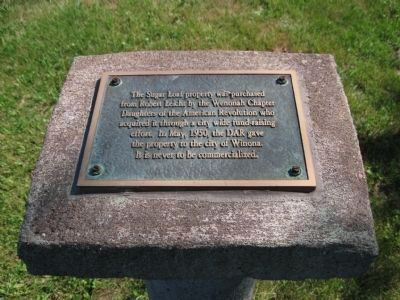
5. Plaque by Marker
This Sugar Loaf property was purchased from Robert Leicht by the Wenonah Chapter Daughters of the American Revolution who acquired it through a city wide fund-raising effort. In May, 1950, the DAR gave the property to the city of Winona. It is never to be commercialized.
Credits. This page was last revised on June 16, 2016. It was originally submitted on June 6, 2011, by Keith L of Wisconsin Rapids, Wisconsin. This page has been viewed 1,312 times since then and 38 times this year. Photos: 1, 2, 3, 4, 5. submitted on June 6, 2011, by Keith L of Wisconsin Rapids, Wisconsin.
