Laurel in Prince George's County, Maryland — The American Northeast (Mid-Atlantic)
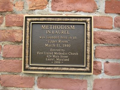
Methodism in Laurel
Erected 1999 by First United Methodist Church.
Topics. This historical marker is listed in this topic list: Churches & Religion. A significant historical date for this entry is March 11, 1863.
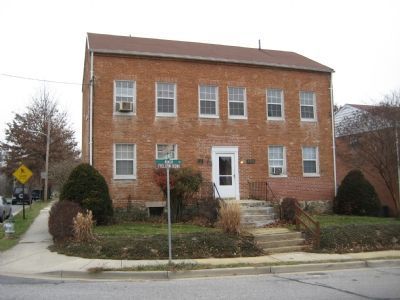
Location. 39° 6.496′ N, 76° 51.478′ W. Marker is in Laurel, Maryland, in Prince George's County. Marker is at the intersection of 9th Street and Park Hill Road, on the right when traveling south on 9th Street. Marker is on building at 123 9th Street. Touch for map. Marker is at or near this postal address: 123 9th Street, Laurel MD 20707, Laurel MD 20707, United States of America. Touch for directions.
Other nearby markers. At least 8 other markers are within walking distance of this marker. Site of The Old Stone Methodist Church (about 300 feet away, measured in a direct line); Early Buildings on St. Mary's Place (about 500 feet away); Desegregation of Laurel Pool (about 500 feet away); Laurel Factory: Prince Georges County's Only Mill Town (about 500 feet away); Laurel Cotton Mill and Dam (about 500 feet away); Laurel Factory: A Mill Town (about 500 feet away); Water From the Dam Powered the Cotton Mill (about 700 feet away); Laurel Harnessed the River to Power the Cotton Mill (about 800 feet away). Touch for a list and map of all markers in Laurel.
Credits. This page was last revised on June 16, 2016. It was originally submitted on December 22, 2007, by F. Robby of Baltimore, Maryland. This page has been viewed 1,070 times since then and 14 times this year. Photos: 1, 2. submitted on December 22, 2007, by F. Robby of Baltimore, Maryland.

