Abilene in Dickinson County, Kansas — The American Midwest (Upper Plains)
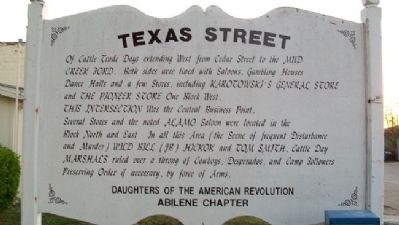
Texas Street
Of Cattle Trade Days extending West from Cedar Street to the Mud Creek Ford. Both sides were lined with Saloons, Gambling Houses, Dance Halls and a few Stores, including Karotowski's General Store and The Pioneer Store One Block West.
This Intersection Was the Central Business Point.
Several Stores and the notes Alamo Saloon were located in the Block North and East. In all this Area (the Scene of frequent Disturbance and Murder) Wild Bill (JB) Hickok and Tom Smith, Cattle Day Marshals ruled over a throng of Cowboys, Desperados, and Camp Followers Preserving Order if necessary, by force of Arms.
Erected by Abilene Chapter, Daughters of the American Revolution.
Topics and series. This historical marker is listed in this topic list: Settlements & Settlers. In addition, it is included in the Daughters of the American Revolution series list.
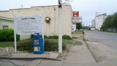
Location. 38° 54.91′ N, 97° 13.008′ W. Marker is in Abilene, Kansas, in Dickinson County. Marker is at the intersection of West 1st Street and Cedar Street, on the left when traveling west on West 1st Street. Touch for map. Marker is in this post office area: Abilene KS 67410, United States of America. Touch for directions.
Other nearby markers. At least 8 other markers are within walking distance of this marker. D. G. Smith Building (within shouting distance of this marker); Union Pacific Depot (about 700 feet away, measured in a direct line); Hotel Sunflower (about 800 feet away); United Building (approx. 0.2 miles away); The Old Chisholm Trail (approx. 0.2 miles away); Dwight David Eisenhower (approx. 0.2 miles away); Trinity Evangelical Lutheran Church (approx. 0.2 miles away); Texas Cattle Trail (approx. 0.2 miles away). Touch for a list and map of all markers in Abilene.
Credits. This page was last revised on June 16, 2016. It was originally submitted on June 29, 2011, by William Fischer, Jr. of Scranton, Pennsylvania. This page has been viewed 829 times since then and 90 times this year. Photos: 1, 2. submitted on June 29, 2011, by William Fischer, Jr. of Scranton, Pennsylvania.

