Jackson in Amador County, California — The American West (Pacific Coastal)
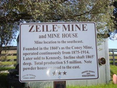
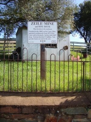
Zeile Mine and Mine House
Mine location to the southeast.
Erected 2004 by Amador County Sesquicentennial Commission. (Marker Number 2.)
Topics and series. This historical marker is listed in these topic lists: Industry & Commerce • Natural Resources. In addition, it is included in the California - Sutter Creek Gold Mine Trail series list.
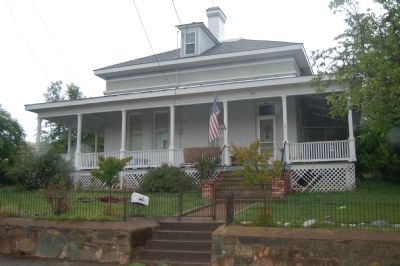
Location. 38° 20.746′ N, 120° 45.965′ W. Marker is in Jackson, California, in Amador County. Marker is at the intersection of Broadway Street and French Bar Road, on the left when traveling south on Broadway Street. Touch for map. Marker is at or near this postal address: 610 Broadway Street, Jackson CA 95642, United States of America. Touch for directions.
Other nearby markers. At least 8 other markers are within walking distance of this marker. William J. Paugh House (approx. 0.4 miles away); Jackson Fire Bell (approx. 0.4 miles away); V. S. Garbarini, Sr. (approx. 0.4 miles away); Masonic Hall & Court House (approx. 0.4 miles away); The Old Spring (approx. 0.4 miles away); Rocca's Hall, Theatre, Arena (approx. 0.4 miles away); Site of 1852 Louisiana House (approx. 0.4 miles away); The Louisiana House (approx. 0.4 miles away). Touch for a list and map of all markers in Jackson.
Regarding Zeile Mine and Mine House. Amador County’s Gold Mine Trail was established as part of the Amador County Sesquicentennial celebration in 2004. It is a 15 mile driving tour of some of the county’s 300+ gold mines. There are 18 official stops and numerous other sites and markers along the trail.
From the Gold Mine Trail booklet: “After the placer gold rush of 1848-50, miners began to dig into the earth and rock to uncover gold imprisoned in quartz rocks’ deep veins. The largest vein was the Mother Lode between Yosemite (Oakhurst) and Georgetown in El Dorado County. The 20-mile stretch for the Mokelumne River to the Cosumnes river was the richest, producing some $160 million in gold between 1851 and 1842 (current value $5 billion).
The first hard rock mines were found in Amador County in 1851. The original Ministers’ claim and the Spring Hill were soon followed by many others: Lincoln, South Spring Hill, Keystone, Original Amador, and Eureka.
By the 1870s-80s Amador County was working 300+ mines. There were some tunnels, but later incline and vertical shafts reached down
a mile into the ground. The Kennedy and Argonaut were close to 6,000’ deep. Headframes crowned shafts and stamp mills processed and crushed the ore. Some mines were worked by their founders but most were sold time and again and were improved or went bust. Large American and foreign companies traded in stock and ran the mines from afar.
Workers came from all over the world to look and work for gold. Most were from Europe: Italy, Yugoslavia, and Cornwall. Many stayed on the settle towns, marry and, raise families. Some mines vanished over the years; others still exist. Of the 300-400 mines, only eight headframes still stand, but many foundations, shafts and surface works remain.”
Additional keywords. Gold Mining
Credits. This page was last revised on June 16, 2016. It was originally submitted on July 13, 2011, by Barry Swackhamer of Brentwood, California. This page has been viewed 871 times since then and 23 times this year. Photos: 1, 2, 3. submitted on July 13, 2011, by Barry Swackhamer of Brentwood, California. • Syd Whittle was the editor who published this page.


