Near Spruce Pine in Mitchell County, North Carolina — The American South (South Atlantic)
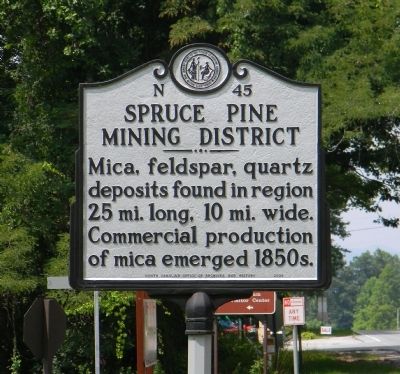
Spruce Pine Mining District
Erected 2004 by North Carolina Office of Archives and History. (Marker Number N-45.)
Topics and series. This historical marker is listed in this topic list: Industry & Commerce. In addition, it is included in the North Carolina Division of Archives and History series list.
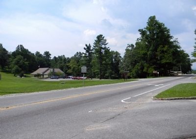
Location. 35° 51.196′ N, 82° 3.038′ W. Marker is near Spruce Pine, North Carolina, in Mitchell County. Marker is at the intersection of State Highway 226 and Blue Ridge Parkway, on the right when traveling east on State Highway 226. The marker is the base of the access ramp to the Parkway at Gillespie Gap. Touch for map. Marker is at or near this postal address: 79 Parkway Maintenance Road, Spruce Pine NC 28777, United States of America. Touch for directions.
Other nearby markers. At least 8 other markers are within 5 miles of this marker, measured as the crow flies. Gillespie Gap (about 400 feet away, measured in a direct line); "The Blackwater Men Had Come Over the Mountain" (about 500 feet away); The Loops (approx. 2 miles away); Sounds From the Mountains (approx. 2 miles away); First Mountain Parkway (approx. 3.1 miles away); Apple Tree (approx. 3.8 miles away); Cathey's Fort (approx. 4 miles away); Near This Point (approx. 4˝ miles away). Touch for a list and map of all markers in Spruce Pine.
Credits. This page was last revised on January 28, 2021. It was originally submitted on July 20, 2011, by PaulwC3 of Northern, Virginia. This page has been viewed 728 times since then and 39 times this year. Photos: 1, 2. submitted on July 20, 2011, by PaulwC3 of Northern, Virginia.

