Near Lincolnton in Lincoln County, North Carolina — The American South (South Atlantic)
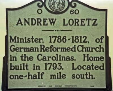
Andrew Loretz
Erected 1968 by North Carolina Archives and Highway Departments. (Marker Number O-60.)
Topics and series. This historical marker is listed in this topic list: Churches & Religion. In addition, it is included in the North Carolina Division of Archives and History series list. A significant historical year for this entry is 1793.
Location. 35° 30.967′ N, 81° 18.911′ W. Marker is near Lincolnton, North Carolina, in Lincoln County. Marker is at the intersection of Reepsville Road (County Route 1113) and Daniels Road (Route 1204), on the left when traveling west on Reepsville Road. Marker is located near Daniels Lutheran Church. Touch for map. Marker is at or near this postal address: 3170 Reepsville Rd, Lincolnton NC 28092, United States of America. Touch for directions.
Other nearby markers. At least 8 other markers are within 4 miles of this marker, measured as the crow flies. Daniels Church (a few steps from this marker); Ramsour-Reinhardt Cemetery (approx. 3˝ miles away); The John Martin Shuford Gravesite (approx. 3.9 miles away); The Aftermath (approx. 3.9 miles away); The Battle (approx. 3.9 miles away); War Comes to North Carolina's Backcountry (approx. 3.9 miles away); The Battle of Ramsour's Mill (approx. 3.9 miles away); The Patriot Captains' Gravesite (approx. 3.9 miles away). Touch for a list and map of all markers in Lincolnton.
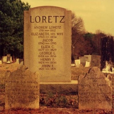
Regarding Andrew Loretz. Loretz is buried in adjacent Daniel's Chapel Cemetery.
Additional keywords. Minister, Reverend, German Reformed Church
Credits. This page was last revised on August 30, 2023. It was originally submitted on July 27, 2011, by Jim Dugan of New Bern, North Carolina. This page has been viewed 485 times since then and 8 times this year. Photos: 1, 2. submitted on July 27, 2011, by Jim Dugan of New Bern, North Carolina. • Bill Pfingsten was the editor who published this page.
Editor’s want-list for this marker. Updated photos • Can you help?

