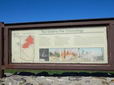
The Galena Fire Chronology
Contributing Factors
For several months prior to the Galena Fire, weather conditions were unusually hot and dry. Average annual precipitation for this region is 18 inches. In the 12 months before the fire only 11 inches fell in the Park.
The Fire Begins
A large lightning storm passed over the Black Hills on the evening of July 4, 1988. On the morning of July 5, staff at Mount Coolidge firetower spotted smoke in a remote section of the Park near Galena Creek. Suppression efforts began immediately.
Summary of the Fire
The fire burned out of control, threatening Park buildings and forcing people to evacuate lodges and campgrounds. More than a thousand firefighters worked around the clock for 4 days attempting to block the spread of flames. Late in the afternoon of July 8, a rain and hail storm helped to control the fire. By the following day, firefighters had built fireline around 90 percent of the fire. By the evening of July 9, the fire was fully contained and mop-up efforts were well underway.
Topics. This historical marker is listed in this topic list: Disasters. A significant historical date for this entry is July 4, 1930.
Location. 43° 47.378′ N, 103° 21.052′ W. Marker is in Keystone, South Dakota, in Pennington County. Marker is on U.S. 16. Marker is in Custer State Park.
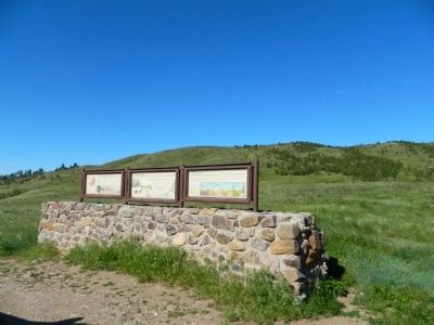
Other nearby markers. At least 8 other markers are within 6 miles of this marker, measured as the crow flies. After the Fire (here, next to this marker); Wildlife and Fire (here, next to this marker); State Game Lodge (approx. 2.3 miles away); Cecil C. Gideon (approx. 2.3 miles away); Peter Norbeck (approx. 2.3 miles away); South Dakota Game Fish & Parks (approx. 2.4 miles away); Civilian Conservation Corps Camp (approx. 4 miles away); “The Badger Hole” (approx. 5.7 miles away). Touch for a list and map of all markers in Keystone.
Credits. This page was last revised on June 16, 2016. It was originally submitted on August 1, 2011, by Bill Pfingsten of Bel Air, Maryland. This page has been viewed 1,101 times since then and 41 times this year. Photos: 1, 2, 3. submitted on August 1, 2011, by Bill Pfingsten of Bel Air, Maryland.


