Silver City in Lyon County, Nevada — The American Mountains (Southwest)
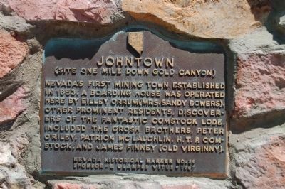
Johntown
(Site One Mile Down Gold Canyon)
Erected 1967 by E Clampus Vitus, Julia C. Bulette Chapter No. 1864. (Marker Number 39.)
Topics and series. This historical marker is listed in this topic list: Settlements & Settlers. In addition, it is included in the E Clampus Vitus series list. A significant historical year for this entry is 1853.
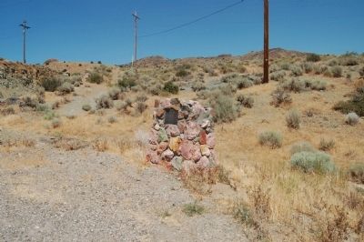
Location. 39° 15.494′ N, 119° 38.124′ W. Marker is in Silver City, Nevada, in Lyon County. Marker is at the intersection of Occidental Grade (State Highway 341) and Old Dayton Toll Road on Occidental Grade. Marker is located just north of the intersection of Nevada State Highways 341 and 342. Touch for map. Marker is in this post office area: Silver City NV 89428, United States of America. Touch for directions.
Other nearby markers. At least 8 other markers are within 3 miles of this marker, measured as the crow flies. Silver City Schoolhouse (approx. half a mile away); Ill-Fated Brothers - Hosea and Ethan Grosh (approx. half a mile away); Devil’s Gate (approx. 0.7 miles away); American City (approx. 2.4 miles away); Jumbo (West Comstock) (approx. 2.4 miles away); Gold Hill Hotel (approx. 2.6 miles away); Gold Hill Brewery (approx. 2.6 miles away); I.O.O.F. Monument (approx. 2.6 miles away). Touch for a list and map of all markers in Silver City.
Additional keywords. Comstock Lode
Credits. This page was last revised on January 28, 2021. It was originally submitted on August 10, 2011, by Barry Swackhamer of Brentwood, California. This page has been viewed 646 times since then and 17 times this year. Photos: 1, 2. submitted on August 10, 2011, by Barry Swackhamer of Brentwood, California. • Syd Whittle was the editor who published this page.

