Stuarts Draft in Augusta County, Virginia — The American South (Mid-Atlantic)
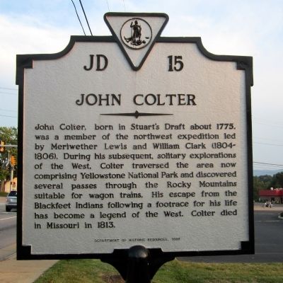
John Colter
Erected 1989 by Department of Historic Resources. (Marker Number JD-15.)
Topics and series. This historical marker is listed in this topic list: Exploration. In addition, it is included in the Virginia Department of Historic Resources (DHR) series list. A significant historical year for this entry is 1775.
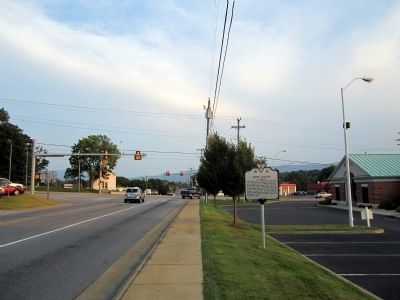
Location. 38° 2.111′ N, 79° 2.108′ W. Marker is in Stuarts Draft, Virginia, in Augusta County. Marker is at the intersection of Tinkling Spring Road (Virginia Route 608) and Stuarts Draft Highway (U.S. 340), on the right when traveling south on Tinkling Spring Road. Touch for map. Marker is in this post office area: Stuarts Draft VA 24477, United States of America. Touch for directions.
Other nearby markers. At least 8 other markers are within 7 miles of this marker, measured as the crow flies. Tinkling Spring Church (approx. 4˝ miles away); Avenue of Trees (approx. 4˝ miles away); Old Glory (approx. 5.6 miles away); Woodrow Wilson Rehabilitation Center (approx. 5.6 miles away); Bethel Church (approx. 5.6 miles away); Roanoke College (approx. 5.7 miles away); Woodrow Wilson General Hospital (approx. 6.1 miles away); a different marker also named Woodrow Wilson General Hospital (approx. 6.2 miles away).
Also see . . . John Colter. Wikipedia (Submitted on August 22, 2011, by Bernard Fisher of Richmond, Virginia.)
Credits. This page was last revised on June 16, 2016. It was originally submitted on August 22, 2011, by Bernard Fisher of Richmond, Virginia. This page has been viewed 1,117 times since then and 47 times this year. Photos: 1, 2. submitted on August 22, 2011, by Bernard Fisher of Richmond, Virginia.

