Camden in Kershaw County, South Carolina — The American South (South Atlantic)
The British Attack
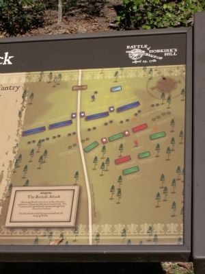
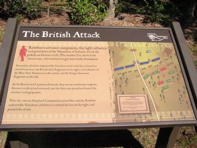
Meanwhile, Rawdon deployed the first three units in his line of march in attack formation: the British 63rd Regiment on his right, a detachment of the New York Volunteers in the center, and the King’s American Regiment on the left.
As the British and Loyalists advanced, they met an unwelcome surprise. Greene’s artillery had returned, and the three six-pounders blasted the attackers with grapeshot.
Then the veteran Maryland Continentals joined the combat. Rawdon ordered the Volunteers of Ireland to extend his line on the right, and pressed the attack.
Topics. This historical marker is listed in this topic list: War, US Revolutionary.
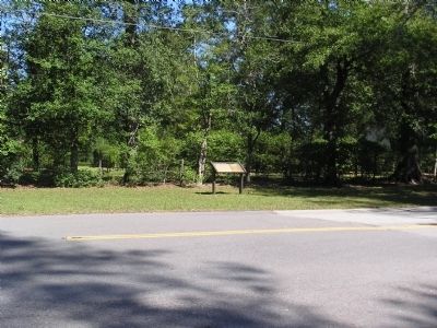
Location. 34° 15.822′ N, 80° 36.158′ W. Marker is in Camden, South Carolina, in Kershaw County. Marker is at the intersection of Greene Street and Fair Street, on the left when traveling north on Greene Street. Touch for map. Marker is in this post office area: Camden SC 29020, United States of America. Touch for directions.
Other nearby markers. At least 8 other markers are within walking distance of this marker. Greene's Counterblow (about 600 feet away, measured in a direct line); William Washington's Ride (about 600 feet away); Battle Of Hobkirk Hill (about 700 feet away); Struggle for the Hill (about 800 feet away); Fruitless Victory (approx. 0.2 miles away); The British Army (approx. ¼ mile away); The Battle of Hobkirk Hill (approx. ¼ mile away); The American Army (approx. ¼ mile away). Touch for a list and map of all markers in Camden.

Photographed By Anna Inbody, October 2, 2011
3. The British Attack Marker
The British Attack
Advancing British units drove in Gen. Greene’s picket line to attack the Maryland Continentals. The Continental Light Infantry fell back through their comrades to reform.
The Marylanders held their ground and met the charging British.
Advancing British units drove in Gen. Greene’s picket line to attack the Maryland Continentals. The Continental Light Infantry fell back through their comrades to reform.
The Marylanders held their ground and met the charging British.
Credits. This page was last revised on June 16, 2016. It was originally submitted on October 25, 2011, by Anna Inbody of Columbia, South Carolina. This page has been viewed 477 times since then and 18 times this year. Photos: 1, 2, 3. submitted on October 25, 2011, by Anna Inbody of Columbia, South Carolina. • Craig Swain was the editor who published this page.

