Camden in Kershaw County, South Carolina — The American South (South Atlantic)
The Southern Campaign, Dec 1778 - Aug 1780
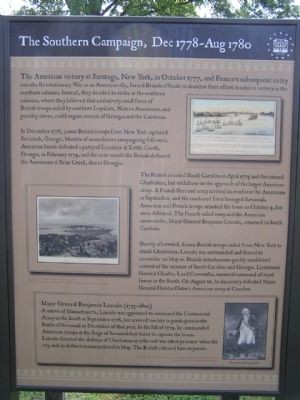
In December 1778, 3,000 British troops from New York captured Savannah, Georgia. Months of inconclusive campaigning followed. American forces defeated a party of Loyalists at Kettle Creek, Georgia, in February 1779, and the next month the British defeated the Americans at Briar Creek, also in Georgia.
The British invaded South Carolina in April 1779 and threatened Charleston, but withdrew on the approach of the larger American army. A French fleet and army arrived to reinforce the Americans in September, and the combined force besieged Savannah. American and French troops attacked the town on October 9, but were defeated. The French sailed away and the American commander, Major General Benjamin Lincoln, returned to South Carolina.
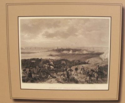
Shortly afterward, 8,000 British troops sailed from New York to attack Charleston. Lincoln was surrounded and forced to surrender on May 12. British detachments quickly established control of the interior of South Carolina and Georgia. Lieutenant General Charles, Lord Cornwallis, assumed command of royal forces in the South. On August 16, he decisively defeated Major General Horatio Gate’s American army at Camden.
Topics. This historical marker is listed in this topic list: War, US Revolutionary. A significant historical month for this entry is February 1779.
Location. 34° 14.053′ N, 80° 36.25′ W. Marker is in Camden, South Carolina, in Kershaw County. Marker can be reached from Broad Street. Marker is located in the Historic Camden Battle Site. Touch for map. Marker is in this post office area: Camden SC 29020, United States of America. Touch for directions.
Other nearby markers. At least 8 other markers are within walking distance of this marker. Camden - Strategic Key (here, next to this marker); The Southern Campaign, Apr 1781 - Dec 1782 (here, next to this marker); The Southern Campaign, Aug 1780 - Apr 1781 (here, next to this marker); The Fortified Post (a few steps from this marker); Palisade Wall (a few steps from this marker); Native Allies (within shouting distance of this marker); War in the Backcountry (within shouting distance of this marker); Women in the Revolution (about 300 feet away, measured in a direct line). Touch for a list and map of all markers in Camden.
Photographed By Anna Inbody, October 2, 2011
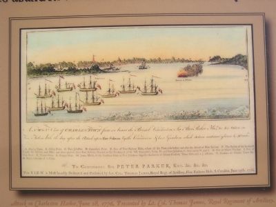
3. Attack on Charleston Harbor, June 28, 1776, Presented by Lt. Col. Thomas James, Royal Regiment of Ar
A NW b. N View of Charles Town from on board the Bristol Commodore Sir Peter Parker Knt,, & c. &c. taken in Five Fathom hole the day after the attack upon Fort Sulivan by the Commodore & his Squadron which action continued 9 hours & 40 mins.
A. Charles Town, B. Ashley River, C. Fort Johnston, D. Cummins’s Point, E. Part of Five Fathom Hole, where all the Fleet rode before and after the Attack of Fort Sulivan. F. The Station of the headmost Frigate the Solebay, two Miles and three quarters from Fort Sulivan, Situated to the Northward of G. NB. Cummins’s Point, D. and Fort Johnston, C. bear nearly N. and S. H. Part of Mount Pleasant. I. Part of Hog Island. K. Wando River. L. Cooper River. M. James Island, at the Southern Point is Fort Johnston, opposite the Centre of Mount Pleasant, Three Miles and a ¼ distance. N. Breakers on Charles Town Bar. O. Rebels Schooner of 12 Guns.
To Commodore Sir P E T E R P A R K E R, Knt. &c. &c. &c.
This V I E W is Most humbly Dedicated and Presented by Lt. Col. Thomas James, Royal Regt. Of Artillery, Five Fathom Hole, S. Carolina, June 29th. 1776.
Photographed By Anna Inbody, October 2, 2011
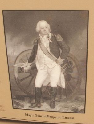
5. Inset on Marker
Major General Benjamin Lincoln (1733 - 1810)
A native of Massachusetts, Lincoln was appointed to command the Continental Army in the South in September 1778, but arrived too late to participate in the Battle of Savannah in December of that year. In the fall of 1779, he commanded American troops at the Siege of Savannah but failed to capture the town. Lincoln directed the defense of Charleston in 1780 and was taken prisoner when the city and its defenders surrendered in May. The British released him on parole.
Major General Benjamin Lincoln
Engraving After Chappel by Johnson, Fry & Co., 1857, courtesy of South Caroliniana Library, University of South Carolina, Columbia, South Carolina.
Credits. This page was last revised on June 16, 2016. It was originally submitted on November 1, 2011, by Anna Inbody of Columbia, South Carolina. This page has been viewed 575 times since then and 14 times this year. Photos: 1, 2, 3, 4, 5. submitted on November 1, 2011, by Anna Inbody of Columbia, South Carolina. • Craig Swain was the editor who published this page.
